Barima-Waini
7.6666666666667 - 59.75Koordinaten: 7 ° 40 'N, 59 ° 45 ' W
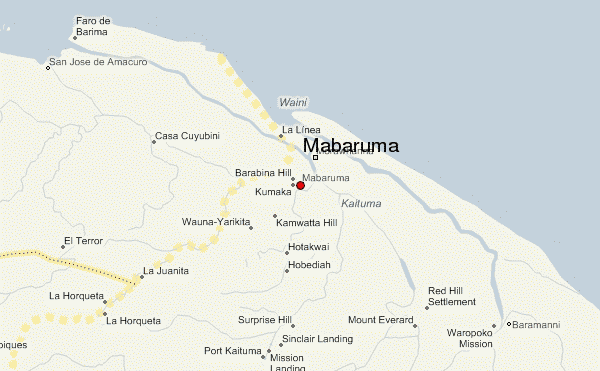
Barima - Waini is a region in northwestern Guyana with an area of 20,339 km ². The region is bordered to the north by the Atlantic Ocean, to the region Pomeroon - Supenaam in the east, the region Cuyuni - Mazaruni in the south and Venezuela to the west. The territory is disputed between Guyana and Venezuela. Before the administrative reform of 1980, the area was known as the Northwest District.
The main towns and settlements are the capital of the region, Mabaruma and Port Kaituma, Matthew 's Ridge, Morawhanna, Towakaima, Koriabo, Hosororo, Arakaka and Moruca. Barima and Waini are two rivers that flow through the densely forested and sparsely populated region.
On the Atlantic coast there are a variety of beaches, including Almond Beach, Luri Beach, Shell Beach, Turtle Beach, Beach Foxes, Iron - punt Beach, Pawpaw Beach and Father's Beach.
Barima - Waini | Cuyuni - Mazaruni | Demerara- Mahaica | East Berbice - Corentyne | Essequibo Islands-West Demerara | Mahaica - Berbice | Pomeroon - Supenaam | Potaro - Siparuni | Upper Demerara - Berbice | Upper Takutu - Upper Essequibo
- Region in Guyana
- Barima - Waini


