Belprahon
Belprahon
Belprahon is a municipality in the administrative district in the canton of Bern Bernese Jura in Switzerland. The former German name Tiefenbach is no longer used today.
Geography
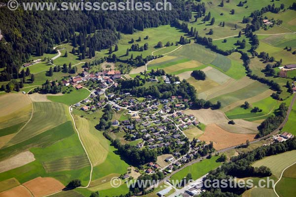
Belprahon is located on 627 m above sea level. M., 2 km east-northeast of Moutier (air line). The farming village extends on the lower southern slopes of Mont Raimeux, in Juralängstal of Moutier, also called the Grand Val.
The area of 3.8 km ² large municipality area includes a small section of the Grand Val The southern border is the river La Raus, a right side of the river Birs. From here, the area extends northward over the relatively gently rising slope of Belprahon and the adjoining wooded and crisscrossed by rocky escarpment of the Forêt du Droit up to the mountain pastures Raimeux de Belprahon on the Mont- Raimeux chain. This mountain meadows with standing individually or in groups large spruces show the typical appearance of the Jura meadows. In the north, the valley of Combe du Pont drained directly into the Birsschlucht north of Moutier. The northern boundary runs along the ridge Arête you Raimeux. The highest point of 1,265 m above sea level with Belprahon is. M. on the apex of the Raimeux chain reaches west of the main summit. From the municipality surface 1997 accounted for 5% on settlements, 54 % of forest and shrubs and 41% to agriculture.
To Belprahon include several individual farms. Neighboring communities of Belprahon are Moutier, Roches, Grandval and Eschert.
Population
With 300 inhabitants ( 31 December 2012) Belprahon one of the small communities of the Bernese Jura. Of the 88.1 % inhabitants are French-speaking, German-speaking 6.4 % and 1.8 % Italian-speaking (as of 2000). The population of Belprahon amounted in 1850 to 126 residents in 1900 to 188 inhabitants. It has increased significantly since 1960 (133 inhabitants).
Economy
Belprahon was until the 1960s a strong dominantly agricultural village, but has since developed into the residential community. Outside the primary sector there are relatively few jobs in the village. Many workers ( around 75 %) are therefore commuters and work primarily in Moutier.
Traffic
The community is located off the major thoroughfares. You can by a short spur road that from the main road Moutier - be achieved branches Balsthal. Currently, the Mont- Raimeux tunnel is built in the A16, passing underneath and the municipality of Belprahon. This highway is to be connected by 2015 both to the Swiss national road network as well as to the French motorway network and receives east of Moutier, around 2 km from Belprahon away, a connection point. The village is served by a bus line that runs between Moutier, Eschert and Belprahon, to public transport.
History
The village name first appears in the 12th century in the documents. Until 1797 Belprahon was under the provost Moutier- Grandval. From 1797 to 1815, the village belonged to France and was initially part of the département du Mont- Terrible, which was connected to the 1800 Haut -Rhin. By the decision of the Congress of Vienna Belprahon came in 1815 to the canton of Bern to the district of Moutier. The village shares since 1967, critical infrastructure, such as the primary school and the wastewater treatment plant, with the neighboring communities.
Attractions
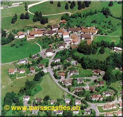
The building of the village school with a bell tower was built in 1872 in the style of late classicism. The old farmhouses dating from the 18th and 19th century give a uniform townscape along with the storage buildings. New residential quarters, including Les Amatennes, developed on the hillside below the village on both sides of the access road. Belprahon does not have its own church, it belongs since 1531 to the Reformed parish Moutier.
Pictures
Farmhouse
Dorfbrunnen


