III. Hornspitze
III. Seen horn tip, left, and IV horn tip from the west
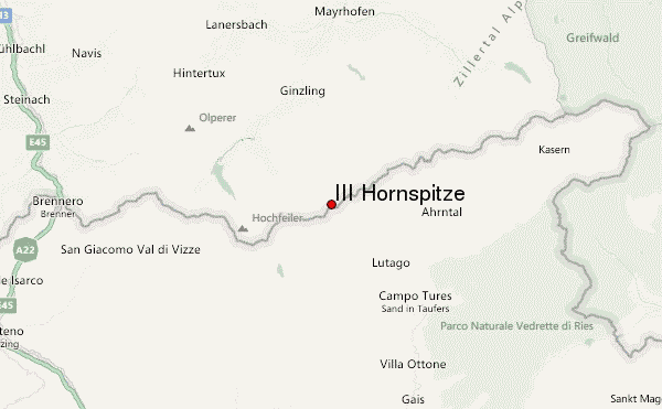
The III. Horn, Horn also highest peak and since the construction of the Berlin lodge called also Berlin 1879 peak, is a 3253 meter high mountain in the main ridge of the Zillertal Alps. He is exactly on the border between Austria, Tyrol, and Italy, Autonomous Province of Bolzano - South Tyrol, and forms the highest point of the south-east trending northwest, about 2.5 km long horn back. Was first climbed the III. Horn in 1874 by the mountain guide Stephan Kirchler and the doctor Josef Daimer and his brother Charles, both of Campo Tures. The III. Horn tip is the highest of the five peaks with that name. The name "Berlin peak " since the 1880s was common in the working environment in the Berliner Hütte mountain guides. Undisputed, the name was not, as you probably feared Prussian dominance.
The other horn tips
In addition to the III. Horn tip, there are four more of the same summit. Altitude (except II horn tip ) after the Austrian Federal Office of Metrology and Surveying:
- I. Horn peak 3172 m
- II H. 3222 m ( altitude by the Alpine Club map 1:25.000)
- IV H. 3198 m
- V. H. 3148 m
Location
The horn back is about eight kilometers in a straight line to the northwest of Ahrntals, 11 kilometers south-southeast of Ginzling, in the municipality of Mayrhofen. He divides the two troughs of glaciers Hornkees in the southwest and Schwarzensteinkees in the Northeast. To the south of the main ridge also houses the small snowfield Mitterbachkees. All glaciers in the area are strongly realized because of global warming on the wane. Adjacent peaks are in the southeast tip of the Berlin I. and II horn tip and in the southwest the IV and V. Horn. Along the ridge lie further to the northeast of the Black Stone with 3,368 meters and 3,418 meters high in the southwest of Turnerkamp.
Bases and routes
As a starting point for a tour of the III. Horn tip of the northwest is the location at 2,042 meters above sea level Berliner Hut. From the hut, the path leads in a south-easterly direction along the Horn. Then over the glacier Hornkees (equipment for Alpinism required) to Mitterbachjoch to 3,130 meters above sea level. Then northeast to the left over to the rocky summit in firn, according to the literature, moderately difficult climbing in the UIAA grade II oversized blocks to the summit. The walk takes about four hours according to the literature. From the south, the Berlin peak of Weissbach (Italian: Riobianco ) can in Ahrntal (Valle Aurina ) from also climbed over the Stabeler - way within the framework of exceeding the Berliner Hütte ( high way) in, according to the literature, about nine hours from Mitterbachjoch from.
Sources and maps
- Heinrich Klier, Walter Klier: Alpine Club leaders Zillertal Alps. Rother Verlag, Munich 1996, ISBN 3-7633-1269-2
- Eduard Richter (Editor): The development of the Eastern Alps, III. Band, publisher of the German and Austrian Alpine Club, Berlin 1894
- Raymond of Klebelsberg: Geology of Tyrol, Berlin 1935
- Alpine Club map 1:25,000, sheet 35/2, Zillertal Alps, middle sheet


