Kaczawskie Mountains
- Western Sudetes
- Mittelsudeten
- Jeseníky Mountains
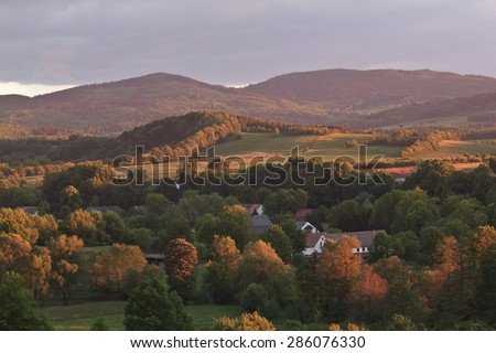
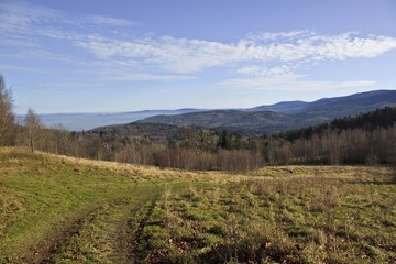
The Kaczawskie Mountains (Polish Kaczawskie ) is the Giant Mountains north of upstream about 30 km long mountain range. It is an extension of the Sudetes and is located in the Polish Lower Silesian Voivodeship. The name derives from the river Bober and Katzbach. The highest elevation is the Melkgelte / Skopiec (724 m). Upstream from the north to the Kaczawskie Mountains is the Kaczawskie Foothills (Polish Pogórze Kaczawskie ), also Goldberger or Jauersche Mountains (Polish Pogórze Złotoryjskie ).
- 4.1 In Kaczawskie Foothills
- 4.2 In the northern ridge
- 4.3 In the main ridge
- 4.4 In the lead ridge
- 4.5 In the little comb
- 4.6 In the Eastern Edge
Location
The running in the northwest-southeast direction ridges with altitudes between 400 and 700 m is a fold mountain consisting of limestone, shale and dolomite. To the west of the Bober separates the Kaczawskie Mountains and the Jizera Mountains Isergebirgsvorland, upstream to the north is the Kaczawskie promontory, in the east the Mad Neisse / Nysa Szalona forms the border. In the southeast the Kaczawskie mountain passes into the Waldburger Bergland / Gory Wałbrzyskie. South then the Landeshuter comb / Rudawy Janowickie and the Jelenia Góra valley forms the transition to the Giant Mountains.
Geology
Basic building block of the mountain is the so-called Giant Mountain granite. Local experience various rocks on, for example, Gneiss, schist, greenstone / diabase, phyllite, quartz (sometimes with graphite), marble ( crystalline limestone, calcite and dolomite), limestone, sandstone, porphyry and basalt. Geologically, this part of the Sudetes is very diverse in formations stretching back to the time of the Cambrian period (500 million years). In the three southern mountain ranges there is a formation of sedimentary rocks is (sandstone, clay, which now appear as slate and phyllite ) and from rocks of organic origin (converted dolomite and limestone, and marble). On the volcanic activity, the rhyolites and Melaphyre remember in the area of Schwarzenbach, as well as the pillow lava around Lähn ( Wleń ). As a result of later volcanic activity Tertiary basalts originated in the area of wall ( Pilchowice ) and Berbisdorf ( Dziwiszów ), and an agate deposit near Liebenthal ( Lubiechowa ) and Neukirch ( Nowy Kościół ).
The relief of the mountain was built during the Alpine orogeny. Your final form were the mountains in the Pleistocene when glaciers covered twice the area of the Kaczawskie Mountains. The glaciers left deposits of glacial till, gravel, sand and boulders. At the end of the Ice Age, the fracture valleys of Bóbr originated near Jannowitz / Janowice Wielkie and Bober Röhrsdorf / Siedlęcin.
Of particular importance are the limestone massifs in buying Fung with the lime works are Tschirnhaus ( tickle mountain / mountain Połom ). There are also some karst caves were formed.
Geography
The Kaczawskie Mountains consists of four different mountain ridges: Northridge, main or south ridge, Little crest and eastern ridge. The three first-mentioned ridges extend in a northwest-southeast direction, the east ridge located east of Katzbach and forms an irregular shape. In many places there are rocks that are formed from various rocks, such as Greenstone / diabase, marble, slate, sandstone and conglomerate, and in return Bober - amphibolite. One example is the so-called " Little Organ " at Moisdorf ( Myślibórz ) in Kaczawskie promontory.
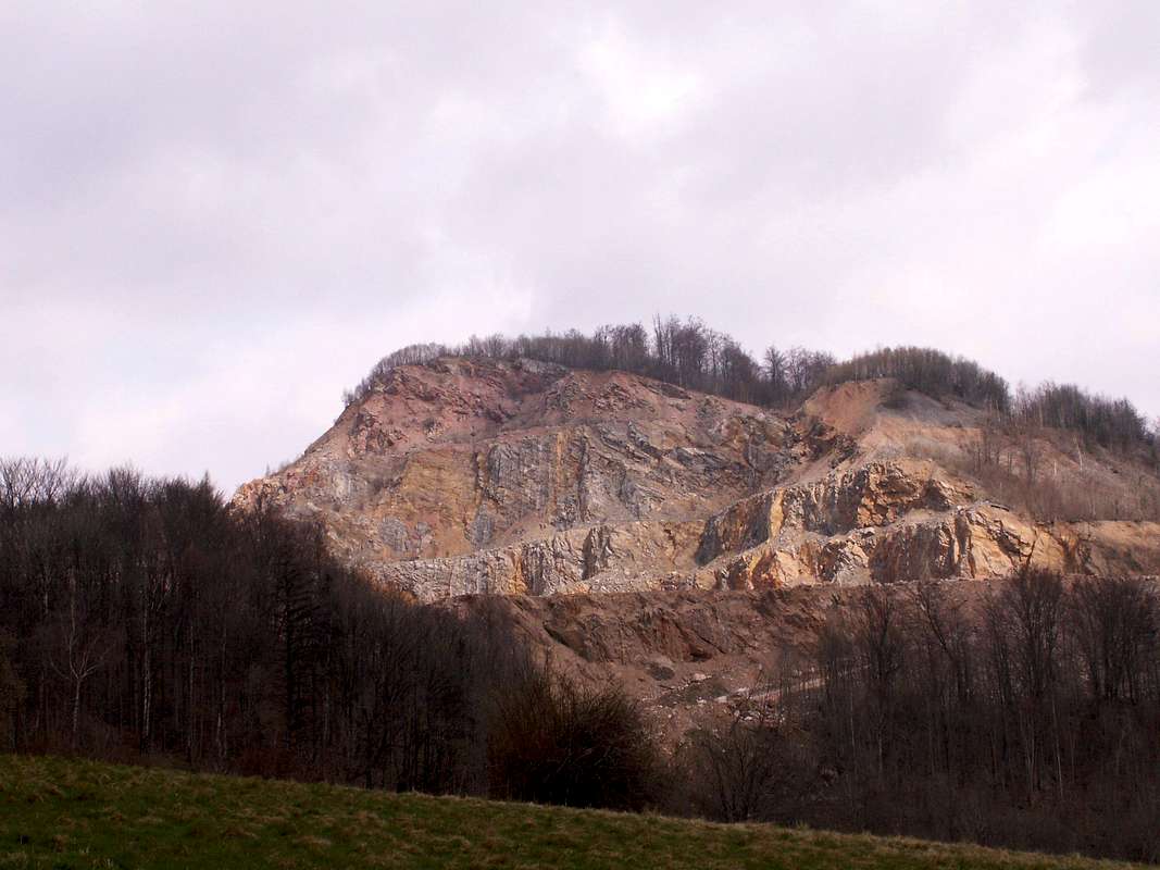
Through the centuries-old mining activity quarries emerged (mainly limestone ) and the original nature has been greatly changed. The best known example is the mountain Połom ( tickle mountain ) - a limestone quarry with almost vertical walls - with purchase Fung ( Wojcieszów ).
Northridge
The northern ridge extending between the Bober ( Bóbr ) at Lähn ( Wleń ) and Toth ( Kaczawa ) with purchase Fung ( Wojcieszów ) north of the valley of Lipka and Świerzawa.
South ridge (including Bleiberg Crest)
The south ridge ( main ridge ) extends south of the valley of Lipka and Świerzawa between Langenau ( Czernica ) and Merzdorf ( Marciszów ). Its eastern part is lead ridge called ( Gory Ołowiane ), this is located southeast of Seiffersdorfer Pass ( Przelecz Radomierska, 523 m).
Small comb
The so-called Little Crest is located south of the main ridge and north of Hirschberg ( Jelenia Góra ) and extends from the wall ( Pilchowice ) to Berbisdorf ( Dziwiszów ).
Eastern Edge
The eastern ridge located east of Katzbachtals between the towns of purchase Fung ( Wojcieszów ) Ketschendorf ( Kaczorów ) Merzdorf ( Marciszów ), Thomas Village ( Domanov ) Bolkenhain ( Bolków ) Leipe ( Lipa ), Small Helmsdorf ( Dobków ) and Altschönau ( Stara Krasnica ).
Significant elevations
In Kaczawskie Foothills
West of the Katzbach
Falk Berge / Sokolowskie Wzgórza at Falk grove / Sokolowice (size, class book Mountain, Sheep Mountain, Geiersberg ); Probst Hainer Spitzberg / Proboszczowice or Ostrzyca Proboszczowicka (501 m).
East of the Katzbach
Wolfsberg / Wilcza Gora or Wilkołak ( 373 m) at Goldberg / Złotoryja; Geiersberg (325 m); Willmann villages Hochberg / Rosocha ( 464 m) at Willmann Village / Stanislawów; Willenberg / Wielislawka (370 m) at Röversdorf / Sedziszowa; Pombsener Spitzberg / Czartowska Skala ( 463 m) at Pombsen / Pomocne; Breiteberg / Bazaltowa Góra ( 368 m); Mochenberg / Mszana ( 475 m); Obloga (442 m); Janus Mountain / Radogost ( 398 m ) at Moisdorf; Rathsberg / Rataj (350 m) at Moisdorf; Orchids hill / Storczykowe Wzgórze (370 m); Mochauer hill / Muchowskie Wzgórza.
In the northern ridge
Hogolie ( Ogule ) / Okole (714 m); Forest Mountain / Leśniak ( 677 m); Scholz Stone / Sołtysie Skały ( 695 m); Zippel Mountain / Wywołaniec ( 543 m); Hornig Mountain / Rogatka (490 m); Steinberg / Skala ( 485 m); Mrs. Berg / Babiniec (486 m ); Kutna Hora / Tarczynka (422 m); Gallows / Szubieniczna (325 m); Günther height / Pańska Wysoczka (658 m); Stumps / Świerki ( 561 m); Gackowa ( 549 m); Freudenberg / Radostka (532 m); Klessenstein / Klęśniak ( 678 m).
In the main ridge
( Its west part is called Ludwig villages mountains or comb / Chrośnickie Kopy, its eastern part is called Bleiberg comb / Gory Ołowiane )
Scratch Mountain / Czernicka Góra (513 m); Bird or finch dump / Ptasia (626 m); Hell mountains / Lastek ( 638, 631 m); Nearly Stone / Kazalnica (620 m); Blücher height / Lysa Gora (707 m); Stangenberg / Leśnica ( 665 m); Chapel Hill / Widok (616 m); Zrobek (616 m); Old horse / Kobylá (626 m); Old horse / Ogier (646 m); Maslak (720 m) with Okopowa (715 m) and Folwarczna; Kammerberg / Skopiec (724 m); Sheep Mountain / Baraniec ( 723 m); Reason Karpacz / Ziemski Kopczyk ( 672 m); Leszczyniec (604 m); Straconka (611 m); Gallows / Dudziarz ( 652 m); Small Miihlberg / Mlynica (462 m); Moosberg / Meszna (590 m ); Moosberg / Bożniak (613 m); Tickle Mountain / Górą Połom ( 667 m).
In the lead ridge
Rose Garden / Różanka (628 m); Bleiberg / Ołowiana (658 m); Schubert Mountain / Turzec ( 684 m); Prittwitz Mountain / Ciechanówka ( 598 m).
In the small comb
Grunau Spitzberg / Stromiec (551 m); Gallows or Schieferberg / Górą Szybowcowa or Szybowisko ( 561 m); Silberberg / srebrna (491 m); Kalkberge / Wapienna (507 m); Lerchenberg / Skowron (472 m); Strzyżową (424 m); Hartberg / Czyzyk (425 m).
In the Eastern Edge
Grosshau / Poreba ( 671 m); Forest Mountain / Lubrzy (666 m); Barstein / Niedźwiedzich Skałek ( 657 m); Skiby ( 562 m); Rakarnią ( 548 m); Rochowicką scale ( 495 m); Wapnikami (509 m); Młyniczną (454 m); Iron Koppe / Żeleźniak (664 m); Wetzelberg / Osełką ( 581 m); Miihlberg / Miłek ( 569, 596, 573 m); Book Mountain / Bukowinka (621 m); Gallows / Głogowiec (535 m); Marie Stein Mart or stone / Marcińcem ( 624 m); Rehberg / Rogacz (617 m); Repprichtsberg / Dłużkiem ( 592 m); Hop Mountain / Chmielar ( 585 m); Meadow mountains / polanka (547 m); Pipe Mountain / Trzciniec ( 469 m); Bielec (450 m); Gallows / Zadora (454 m); Lindenberg / Lipna (436 m); Rufferstein / Garb ( 404m ).
Specific rock formations
- " Little Organ " ( basalt) on the ratchet mountain at Moisdorf / Myślibórz
- " Great Organ" ( porphyry ) at Willenberg / Wielislawka at Röversdorf / Sędziszowa
- Raven Dock (sandstone walls) by the train station bathroom Hermsdorf / Jerzmanice Zdrój
- Basalt columns at Mochau / Muchow and Konrad Waldau / Kondratov
- Limestone quarry on the mountain tickle with stalactite caves
- Raven Cliffs at Jannowitz / Janowice Wielkie
- " Vandal - grave " / Grób Wandalów on the road 365 between Hirschberg and Berbisdorf / Dziwiszów
Former Volcanoes ( basalt mountains, usually referred to as " Spitzberg " ):
- Gröditzberg / Grodziec (407 m)
- Wolfsberg / Wilcza Góra or Wilkołak ( 367 m)
- Breiteberg / Bazaltowa Góra ( 368 m) at Poischwitz / Paszowice
- Ratchet Mountain / Rataj (350 m) at Moisdorf / Myślibórz
- Heßberg / Górzec at Mr. Mansfield Village / Mecinka
- Pombsener Spitzberg / Czartowska Skala ( 463 m)
- Probst Hainer Spitzberg / Ostrzyca Proboszczowicka (501 m, called " Silesian Fujiyama " )
- Mountains and rock formations in Kaczawskie Mountains
Large rock organ with Röversdorf
Pombsener Spitzberg at Pombsen
Wolf at Wolf Mountain Village
Canyons and passes
- Leiper 's Canyon / wąwóz Lipa
- Seven Hufener Gorge / wąwóz Siedmicki
- Neudorf 's Canyon / wąwóz Nowowiejski
- Moisdorfer Gorge / wąwóz Mysliborski
- Ludwig villages Pass / Przelecz Chrośnicka ( 561 m)
- Chapel Sattel / Przelecz Widok - Capella ( 582 m)
- Pass / Przelecz nad Kobylá ( 592 m)
- Chamber Waldauer pass / Przelecz Komarnicka (662 m)
- Seiffersdorfer pass / Przelecz Radomierska ( 523 m)
Nature parks
- Landscape Park Chelmy / Landscape Park Chełmy
- Landscape Park Lower Bobertal / Landscape Park Doliny Bobru with the lion Berger Switzerland
- Landscape Park Landeshuter comb / Rudawski Landscape Park
Waters
The Kaczawskie mountain range lies within the catchment area of the Oder.
- Bober / Bóbr
- Skora / Skora
- Katzbach / Kaczawa
- Mad or Jauersche Neisse / Nysa Szalona with the left tributary Small Neisse / Nysa Mała
- Steinbach of Schönau in direction kingdom Waldau - Mochau
- Rothebachtal at Falk Hain ( tributary of the rapids Skora )
- Helmsbachtal of Schönau small Helmsdorf
- Erlenbachtal east of purchase Fung ( in the direction of Altenberg )
- Mühlenbachtal between Neudorf and Seven hooves
- Valley of the Little Neisse in Blumenau - Falkenberg
Selected places in Kaczawskie Mountains (including the foothills )
- Jawor / Jawor
- Goldberg / Złotoryja
- Röversdorf / Sędziszowa
- Schönau an der Katzbach / Świerzawa
- Purchase Fung / Wojcieszów
- Probsthain / Proboszów
- Deep Hartmann Village / Radzyn
- Ludwig Village / Chrośnica
- Berbisdorf / Dziwiszów
- Ketschendorf / Kaczorów
- Small Helmsdorf / Dobków
- Leipe / Lipa
- Mochau / Muchow
- Konrad Waldau / Kondratov
- Pombsen / Pomocne
- Willmann Village / Stanislawów
- Moisdorf / Myślibórz
Attractions
- Probsthain / Proboszów with former evangelical church
- Deep Hartmann village with lookout tower and castle (former owner: Vitzthum of Eckstadt )
- Coordinates stone ( 51 ° N, 16 ° E ) in Mochauer Forest ( basalt column )
- Late Romanesque church of Saints John and Catherine of Alexandria in Schoenau on the Katzbach
- Walońska Cave of the White Rock ( Białe Skały ) north of chamber Waldau ( Komarno )
- Age arsenic tunnel near Altenberg ( Radzimowice )
- Bolkoburg ( Zamek Bolkow ) and pig house Castle ( Zamek Świny ) at Bolkenhain ( Bolków )

