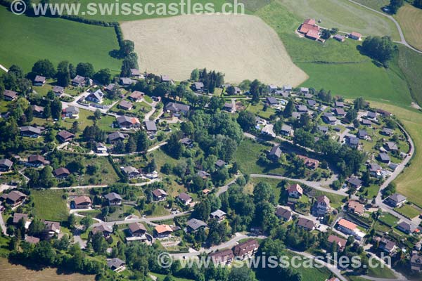
Plasselb
Village Plasselb
Plasselb ( Freiburg Patois Pyanachiva? / I ) is a municipality in the district of Sense (specifically the Senseoberland ) of the canton of Fribourg in Switzerland.
Geography
Plasselb is situated 856 m above sea level. M., 11 km southeast of the capital of the canton of Fribourg (air line). The village is located on a terrace east of Ärgera, on their exit from the Fribourg Pre-Alps, at the northern foot of the Schwyberg.
The area of 18.1 km ² large municipality area includes a portion of the Fribourg Pre-Alps. The northernmost part of the municipality is occupied by the basin of Plasselb between the Ärgera the west and the Sensetal in the east. This valley is bounded on the north by the heights of Lantershubel ( 1,024 m above sea level. M. ) and top wood. West adjoins the Valley of Ärgera which has a up to 400 m wide flat valley floor, with erosion material (gravel, sand) filled from the catchment area and is partially wooded. In this northern community area is the western boundary of Muelersbach, a left side of the creek Ärgera formed.
To the south of the municipality extends to the floor in relief strongly upper catchment area of the Ärgera in the foothills and is divided into two strips. Here there are vast forests and grasslands. The southwestern portion comprises the left flank of the Ärgera in the so-called Plasselbschlund, where the western boundary runs along the ridge of small Käseberg Petit Cousimbert ( 1,530 m above sea level. M. ) and Chrüzflue Muschenegg ( 1,263 m above sea level. M. ). The southeastern portion extends on the eastern side of the valley of the Höllbachs ranges in the south in the Philiponerwald and up into the catchment area of the Black Sea fox - Schwyberg. Here the eastern border runs along the crest of the Schwyberg; on the Great Schwyberg is with 1'645 m above sea level. M. reached the highest point of Plasselb. The Kapberg lying between Ärgera and Höllbach belongs to the municipality of Val -de- Charmey. From the municipality surface 1997 4 % came from settlements, 56 % of forest and shrubs, 38% to agriculture and slightly more than 2% was unproductive land.
To Plasselb the hamlet Neuhaus include ( 973 m above sea level. M. ) on the saddle between Lantershubel and upper wood, the cottage area Birchi - Hubel (960 m above sea level. M. ) on the hillside above the village, hospital - intent, Muelers as well as numerous individual farms. Neighboring communities of Plasselb are Oberschrot, Plaffeien, Val -de- Charmey, La Roche, Le Mouret, St. Silvester and Giffers.
Population
With 1020 inhabitants ( 31 December 2012) Plasselb one of the smaller municipalities in the canton of Fribourg. Of the residents 93.2 % are German, 2.2 % French-speaking and 2.1 % speak Albanian (as of 2000). The population of Plasselb amounted in 1900 to 467 inhabitants. During the 20th century, a slow but steady increase in population was observed in total. Since 1970 (648 inhabitants), population growth has strengthened.
Economy
Plasselb was until the second half of the 20th century, mainly coined by farming village. Even today, the dairy industry, animal husbandry and forestry have an important place in the economic structure of the population. More jobs are in small local manufacturing and services available. In Plasselb there are companies in the wood processing and furniture manufacturing, the transport industry, construction of agricultural machinery and heat technology. Jobs in the tertiary sector are concentrated next to the Administration, especially the tourism sector ( hotels and restaurants, crafts, etc.). In recent decades, the village has developed into a residential community. Many workers are therefore commuters who work mainly in the region of Freiburg.
Traffic
The community is conveniently comparatively quite well developed. It lies on the main road from Freiburg to Plaffeien and in the region Schwarzsee. By Bus Transports Publics Fribourgeois that leads from Freiburg to Plaffeien Plasselb is connected to the public transport network.
History
Records for the first mention of the place in 1236 under the name silva plana (derived from the Latin with the meaning of flat forest ). Later, the names Plannaseyva ( 1324 ), Blanselp ( 1364 ) published for the first time Plasselb ( 1445 ) and Plannasewa ( 1472 ).
1476 Battle of Murten, with taking into account a " rice - Compagnie " of 8 -equipped men.
The feud Plasselb belongs in the Middle Ages Rudolph Ecublens, who sold it in 1291 to the Bishop of Lausanne. In the following years there have been numerous changes of ownership, among them were also the men of Corbières, of Englisberg and the family VELGA. By buying Plasselb came in 1486 under the rule of Freiburg and the Old Landscape ( Burgpanner ) has been assigned. After the collapse of the ancien régime (1798 ) belonged to the village during the Helvetic Republic and the subsequent time to the district of Freiburg, in 1831 the German district of Freiburg, before it was incorporated in 1848 with the new cantonal constitution in the sense newly created district.
Effective as of January 1, 1971 Neuhaus was incorporated into Plasselb.
In 1994, the end of winter on the eastern side of the valley of the Höllbachs below the Schwyberg after a long time very rainy period of the slope in motion. This landslide with various debris flows eventually led to the complete destruction of the cottage settlement Falli - Hölli with around 30 houses.
Ecclesiastical belonged to the parish Plasselb first legal hold, from 1519 to the parish Plaffeien and after various disputes about the service there was in 1720 raised to the independent parish.
Attractions
The parish church of St. Martin in 1814 built on the site of an older temple and from 1972 to 1973 restored inside and outside in 1986.
West of the Ärgera is the Muelersgrotte at the foot of a sandstone rock.


