Thorens-Glières
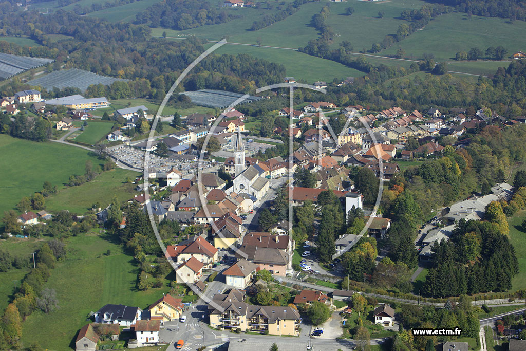
Thorens- Glières is a commune in the French department of Haute- Savoie department in the Rhône-Alpes region. It is the capital of the canton of Thorens- Glières in the arrondissement of Annecy.
Geography
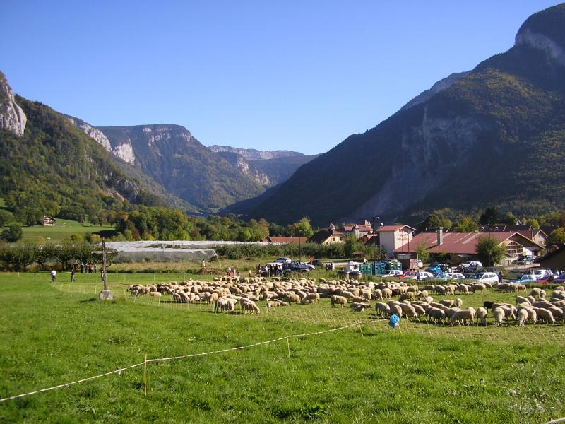
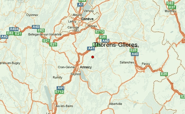
Thorens- Glières is on 674 m above sea level, about 14 kilometers northeast of the town of Annecy (air line). The village is located in an open valley of Filière, on their exit from Bornes the Alps, at the northern foot of the massif of the Tête du Parmelan, in Genevois.
The area of 63.05 square kilometers municipal area includes a portion of the Savoy Alps. Geographically, the area is divided into three parts. In the southern part there is the valley of the Filière, which rises north of the Tête Ronde in the Bornes Alps and first through a deep valley flanked by steep, and traversed by bands of rock slopes, flows to the northwest. In Thorens- Glières the Filière reached after a narrow valley, the foothills of the Alps and is now turning westward in an open valley, where the river marks the southern boundary of the municipality.
The northern part of the municipality is occupied by a broad ridge with high plateau, which to Bornes area of the plateau part ( between the Salève and the Bornes Alps ). This 950 m high back is bordered to the west by the valley of the Daudens, on the east by that of the flan.
Reliefed Stark is the eastern part of the municipality. It comprises the karst, corrugated plateau, the edge of the chains Bornes Alps. As a prominent mountain peak rises due east of Thorens- Glières the Montagne de Sous- Dine, a steep flanks and a rugged, characterized by karst formations high surface on which with 2004 m the highest peak of Thorens- Glières is achieved. Southeast of the Montagne de Sous- Dine close to the drain of Champ Laitier, the Montagne des fretes (up to 1914 m), the plateau of the Glière (1400 m) and the crest of the Montagne of the eye (up to 1909 m).
To Thorens- Glières next to the village itself includes various hamlet settlements and farmsteads, including:
- Gorez (590 m ) in the valley of Filière
- Battendier (680 m) on the ledge between Filière and Daudens
- Laffin (712 m) on the northern flank of the Filière
- Le Chêne (820 m ) at the level of the plateau Bornes
- Nantizel (860 m ) at the level of the plateau Bornes
- Les pellets (850 m ) at the level of the plateau Bornes
- Guichard (770 m) on a hillside overlooking Thorens- Glières
- Les Noyers ( 754 m) at the flan at the western foot of the Montagne de Sous- Dine
- La Lua ( 800 m) at the flan at the western foot of the Montagne de Sous- Dine
- Les Molliets (900 m) on the northern slope of the valley of the flange
- Les Cheneviers ( 1060 m) at the northern foot of the Montagne de Sous- Dine
- Mont Piton (1070 m) at the northern foot of the Montagne de Sous- Dine
- Sales ( 690 m) above the mouth of the flan in the Filière
- Usillon (750 m) in the basin of the Filière
- Nant- Sec ( 768 m) in the basin of the Filière
- La Verrerie (760 m) in the basin of the Filière
- Le Jourdil (750 m) in the basin of the Filière
Neighboring communities of Thorens- Glières are Évires and La Roche- sur -Foron in the north, Le Petit- Bornand -les- Glière in the east, Entremont, La Balme -de- Thuy, Dingy- Saint- Clair, Aviernoz and Ollières in the south and Groisy in the West.
History
The territory of Thorens- Glières been inhabited since the Neolithic period. The village is mentioned in a document in 1336 under the name Thorento. In the 15th century the names Thorens and Thorenc appeared much later, are also Thoyrens, Thoreyns and Thorin handed. In the 19th century the church Thorens -sales and on Thorens- les- Glière was called; only in the year 1947, the current community name has been introduced. The place name may be traced back to the Latin word torrens ( torrent ).
Since the 13th century Thorens made a rule that was later under the suzerainty of the Count of Geneva. In 1401 it passed the House of Savoy and henceforth shared its fate.
During World War II Thorens- Glières gained importance as a stronghold of the French resistance fighters. This built on the hard to reach plateau Glières a fortified camp, which was twice unsuccessfully attacked in 1944 by armed forces of the Vichy regime. Only a 12,000 -strong German troops could occupy the camp, where around 300 people were killed on both sides. The camp was, however, recaptured some time later by the resistance fighters. Thus, the final expulsion of the fascists began in the département of Haute -Savoie.
Attractions
The parish church of Thorens- Glières its current form is in a new building in neo-Gothic style in the 19th century, the choir of the previous building was involved from 1450 in which the native-born Francis de Sales was consecrated bishop. In various hamlets chapels, the Chapel in sales stand ( built in 1677, with the laying of the grave Roussy de Sales family), the Chapel of Pierre- Taillée and the chapel in Usillon.
Of the secular buildings the Thorens Castle is one of the major attractions. It was built around 1060, which from this time only foundation walls and basement are preserved. From the 13th century the round keep and some living rooms come while the main part of the castle was remodeled in the 19th century. Another rule seat was the castle Sales, on the grounds there is a chapel today. On the plateau of Glière information boards about the fighting in World War II. As a memorial to remember a memorial and a chapel at this time. The memorial is by Émile Gilioli of 1973: The National Monument of resistance ( Monument National de la Résistance, inaugurated by André Malraux ).
Population
With 3163 inhabitants ( 1 January 2011) Thorens- Glières belongs to the medium-sized towns in the Haute-Savoie region. During the 19th and 20th centuries, the population steadily increased due to high levels of emigration from (1861 were still 2507 inhabitants counted in Thorens - Glières ). Since the early 1970s, however, a significant increase in population was recorded again.
Economy and infrastructure
Thorens- Glières was until well into the 20th century a predominantly coined by agriculture and alpine farming village. Today there are various companies of small and medium enterprises. Tourism also (mostly summer tourism) has helped the community to an economic upturn. Many workers are commuters who engage in space Annecy their work.
The village is located off the major thoroughfares. The main access is from the main road N203 (Annecy -La Roche- sur -Foron ) through the valley of Filière. Further road links exist with La Roche- sur -Foron, Évires and Villaz. The nearest links to the A41 motorway is located at a distance of around 13 kilometers. The nearest railway station is located in the neighboring Groisy on the railway line Aix -les- Bains- Annemasse.
Personalities
- Francis de Sales was born on August 21, 1567 at the Château de Sales.


