Ahlsburg
P1
Northeast side of the ridge Ahlsburg
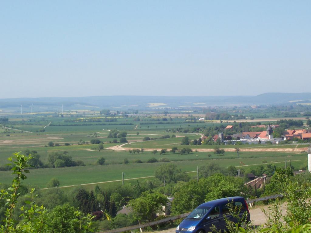
The Ahlsburg in the Lower Saxony town of Northeim district is one to 411.4 m above sea level. NHN high red sandstone ridge in the foothills Solling, a part of the Weser -Leine Uplands.
Geography
Location
The Ahlsburg located in the center of the district of Northeim. The mountain range is located south of Ilmetals and forms a southern end of Einbeck Mark Oldendorfer basin. In northwest-southeast direction it extends south-southwest of lying on the Ilme Einbeck, west of the Leine valley, west-northwest of the leash passed Northeim, north-northwest of Moringen, northeast of Fredelsloh, east of the Solling and southeast of Dassel and the Ellenser forest. The wooded Ahlsburg belongs to the city and municipalities of Dassel, Einbeck, Northeim and Moringen. It is approximately 10 km long and a maximum of about 3 km wide.
Nature Spatial allocation
The Ahlsburg is assigned to the natural area as follows:
- ( 37 Weser -Leine Bergland ) ( to 371 Solling foreland ) 371.1 Southern Solling- foreland 371.12 Ahlsburg
Mountains
To the mountains and elevations of the ridge Ahlsburg include - with height in meters ( m) above mean sea level ( MSL; unless otherwise called loudly BfN card service ):
- Sackberg ( 411.4 m)
- Ochsenberg ( 371.5 m)
- Duck Steinberg ( 360.1 m)
- Fast calibration ( 355.5 m)
- Südlieth ( 325.9 m)
- Mountain pastures ( 308.7 m)
- Iberg ( 303.0 m)
- Action mountain ( 298.2 m)
- Unnamed mountain with a castle Grubenhagen ( 298.0 m)
- Böllenberg (297 m)
- Foothill ( 289.1 m)
- Behrens mountain ( 277.9 m)
- Drugs mountain ( 250 m)
- Kate Stone ( 240.7 m)
Watercourses
Among the rivers in and around the ridge Ahlsburg (all in the catchment area of the canvas ) include:
- Bölle ( rises on the southern edge of the ridge, passes through its southern foothills and is a western tributary of the Leine)
- DIESSE ( rises on the eastern edge of the Solling, passes through the western slope of the ridge and is a tributary of the southsouthwest Ilme )
- Ilme ( passes the ridge some distance to the north and is a western tributary of the Leine)
- Line ( passing the ridge some distance to the east and is a southern tributary of the Aller)
- Rebbe ( rises in the central part of the ridge and is a southern tributary of the Ilme )
- Rottenberg ( springs north of the ridge and is a southern tributary of the Ilme )
- Hane ( rises in the central part of the ridge and is a southern tributary of the DIESSE ).
Attractions
Other attractions in and around the ridge Ahlsburg include - with height in meters ( m) above mean sea level ( MSL ):
- Castle Grubenhagen ( 298.0 m)
- Fredelsloh (about 270 m, artists and potters village)
- Emperor Oak ( about 240 m)
- Quast beech ( 331 m)
- Steel Beech (approx. 310 m)
- Wüstung Bengerode (about 265 m, medieval pottery settlement ).
References and Notes
- Mountains in Europe
- Mountains in Germany
- Mountain
- Forest area in Lower Saxony
- Forest area in Europe
- Geography ( district of Northeim )
- Dassel
- Einbeck
- Moringen
- Northeim


