Akitakata, Hiroshima
Akitakata (Japanese安 芸 高田 市) is a city with about 33,000 inhabitants in Hiroshima Prefecture in Japan. In the agricultural community to a variety of traditional folk festivals received.
History
The local government unit Akitakata was on 1 March 2004 from the Association of Municipalities Hachiyo (八千 代 町, chō ), Koda (甲 田 町, chō ), Midori (美 土 里 町, chō ), Mukaihara (向原 町, chō ), Takamiya (高 宫 町, -chō ) and Yoshida (吉田 町, -chō ) of the district Takata founded. The county was thereupon be dissolved.
Traffic
Akitakata is on the Chugoku Expressway and the National Highway 54 accessible to Hiroshima and Matsue and the National Road 433. The municipality is located on the railway line JR West / Geibi line to Niimi and Miyoshi and the JR Sanko Line to Gotsu and Miyoshi.
Twinning
In the thirties there was a initiated the Red Cross school partnership with the Taunus village Strinz - Margarethä and the Japanese community Ikeguwa. 1956 Ikekuwa was merged with other villages to Midori - chô ( Midori - city). 2004 Midori - chô was in turn merged with other municipalities to manage unit: Aki Takata -shi (city Akitakata ) in Hiroshima Prefecture. Ikekuwa is now only a part of the municipality of Akitakata.
Sons and daughters of the town
- Mōri Motonari ( daimyo Japanese Sengoku period )
- Mōri Terumoto ( daimyo Japanese Sengoku period )
Adjacent Cities and Towns
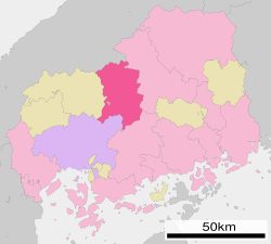
In the north Akitakata borders the Shimane Prefecture and to the east by Miyoshi. In the south, the municipality of Higashihiroshima and in the southwest the capital of Hiroshima prefecture.


