Bachseifen
BW
Template: Infobox River / BILD_fehlt
The Bach soaps is a 2.27 km long, northern tributary of Heller in the Siegen -Wittgenstein in North Rhine -Westphalia ( Germany ).
Course
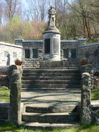
The creek originates north of Würgendorf in Burbach. The source of the stream is located at an altitude of about 530 m above sea level. NHN on the western slope of the wood Holzer head ( 543 m above sea level. NHN ) and very near to the thunder Hain ( 561 m above sea level. NHN ). The creek wanders in its southern course of the eastern slope of the mountain cock ( 499 m above sea level. NHN ) with the springing there " Siegbach ". The further course leads through a narrow valley, the so-called "Bach forest ". This valley is characterized by its moisture and its large holdings of ancient beech forests.
After about 2.3 km, the river flows west of soaps Würgendorf to about 390 m above sea level. NHN in the Heller.


