Beke (Lippe)
The Beke in Altenbeken
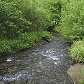
The Beke is a 17.6 km long, orographic left or eastern tributary of the lip in North Rhine -Westphalia, Germany.
Geography
The Beke ( Low German for " Bach" ) originates in Altenbekener Buke district at an altitude of 317 m above sea level. NN. Until Altenbeken northward flowing here she turns its course to the west. In the near the beginning of Altenbeken the Beke first the water of Apuhls flows to, then you flow the springs from the Max-und- Moritz- source stream that springs from the " Boller Born" source mentioned watercourse and comes from the north Sage Bach. About two miles west of the viaduct Altenbekener takes Beke from the right only temporarily flowing Durbeke on which springs half a mile north of Kempen on the Rhine -Weser watershed. About a kilometer east of the Neuenbeken Beke finally takes from the left nor the Silberbeke from the Dunetal, a typical dry ravine, but which very rarely and leads only after prolonged heavy rain or after the snow melt water. Later in the Beke takes no further streams more, and continues to flow in a predominantly westerly direction, through the Paderborn Districts Neuenbeken and Marienloh before then flows into the lip.
Water management
In the summer there are usually dry much of the Beke. The stream trickles from about one kilometer above Neuenbeken in the karst underground, so he temporarily leads to the front Marienloh no water. Through a small source Beke leads from there, at least as a small trickle throughout the year up to its confluence with the lip water. In winter, or after heavy rains the creek leads over its entire length water. When snow melt or rain the water level of Beke is partly so high that you can go canoeing.


.jpg/120px-Paderborn_-_2015-10-18_-_Beke_Marienloh_(01).jpg)


