Boissia
Boissia is a commune in the French department of Jura in the Franche -Comté.
Geography
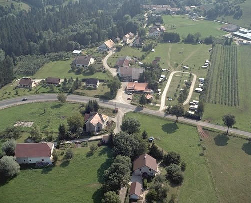
Boissia is located on 484 m above sea level. M., approximately 16 km east-southeast of the town of Lons -le- Saunier (air line). The farming village extends in the Jura, on a plateau in the valley of Combe d' Ain, east of the river of the Ain, south of the Taleinschnitts of Drouvenant.
The area of 5.67 km ² municipal area includes a portion of the French Jura. The central area is occupied by a plateau, which is part of the Valley of the Combe d' Ain and is mainly covered by arable and meadow land. It is on average 480 m above sea level. M. This plateau is bounded on the north by the up to 40 m deep valley cut of Drouvenant ( left tributary of the Ain ). To the south, the municipality's area extends to the uppermost portion of the reservoir Vouglan which is sunk here about 60 m into the surrounding plateau. With 528 m above sea level. M. is achieved on the site back west of Clairvaux- les -Lacs is the highest elevation of Boissia.
To Boissia addition to the actual site also includes several hamlets and farm groups, including:
- Bissia ( 485 m above sea level. M. ) on the plateau east of the Ain
- Piételle (486 m above sea level. M. ) on the plateau above the valley section of the Vouglan
Neighboring communities of Boissia are Vertamboz in the north, Clairvaux- les -Lacs in the east, Barésia -sur- l'Ain in the south and Pont -de- Poitte and Patornay in the West.
History
Several findings indicate that the municipality of Boissia was already inhabited during the Bronze Age and the Iron Age. First mentioned is the place in the 13th century. Since the Middle Ages Boissia belonged to the barony of Clairvaux. Together with the Franche -Comté reached the village with the Peace of Nijmegen in 1678 to France. To a field change occurred in 1822 when the two previously independent small communities Bissia and Piételle were combined with Boissia.
Attractions
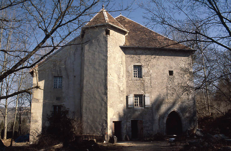
The Château Au Village with its staircase tower was built in the 16th century and modified in the 17th century.
Population
With 137 inhabitants (as of 1 January 2011) Boissia one of the smallest towns in the Jura. Once the population has consistently had in the first half of the 20th century in the range of about 120 people, she took in the second half somewhat. In recent years, a slight increase in population was recorded again.
Economy and infrastructure
Boissia was until well into the 20th century a predominantly coined by the agriculture and forestry through the village. Even today, the inhabitants live on the merits of the activity in the first sector. Outside of the primary sector, there are few jobs in the community. Some employed persons are also commuters who engage in the surrounding larger towns of their work.
The village has good transport links. It is located near the main road N78, which runs from Lons -le- Saunier to Saint -Laurent -en- Grandvaux. Further road links exist with Charcier and Barésia -sur- l'Ain.
Barésia -sur- l'Ain | Boissia | Charcier | Charézier | Chevrotaine | Clairvaux- les -Lacs | Cogna | Doucier | Fontenu | La Frasnée | Le Frasnois | Hautecour | Largillay - Marsonnay | Marigny | Menétrux -en- Joux | Mesnois | Patornay | Pont -de- Poitte | Saffloz | Songeson | Soucia | Thoiria | Uxelles | Vertamboz
- Commune in the department of Jura
- Place in Franche -Comté


