Bonne, Haute-Savoie
Bonne, unofficially Bonne -sur- Menoge called, is a village in Haute - Savoie department in the Rhône-Alpes region.
Geography
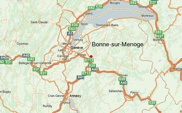
Bonne is located at 500 m above sea level. M., approximately 14 km east-southeast of the city of Geneva (air line). The village extends into the Talniederung the Menoge at the confluence of the Foron as well as on a ledge north of the valley (Haute Terrebonne), at the edge of Arvetals, at the southern foot of the ridge Les Voirons.
The area of 8.58 km ² municipal area includes a portion of the lower Arvetals. The area is crossed from east to west of the Menoge (right tributary of the Arve ) in a 30 m sunk into the surrounding valley. South of the Menoge enough the community area on the plateau of Loëx (up to 520 m above sea level. M. ). To the north it extends over the slopes of Les Voirons to a projection below Le Pralère on which with 1303 meters above sea level. M. the highest elevation of Bonne is achieved.
The municipality consists of the villages of Upper and Lower Bonne Bonne and various hamlet settlements, including Loëx (518 m above sea level. M. ) on the plateau between Arve and Menoge, Chamagnou (520 m above sea level. M. ) at the foot of Les Voirons and Lachat ( 915 m above sea level. M. ) on the southern slopes of Les Voirons. Neighboring communities of Bonne Lucinges are in the north, Fillinges in the east, the south and Nangy Arthaz -Pont -Notre -Dame and Cranves -sales in the West.
History
The municipality of Bonne was already inhabited in prehistoric times. Today's local name goes back to the Gallic word bona meaning of fortified village. First Bonne is mentioned in documents in 1246. Since that time Bonne consisted of two districts: the spots Haute Bonne on the ridge above the Menogetal, which was fortified in the 13th century by the Counts of Savoy, and the lower district of Basse Bonne. In the 14th century the town was equipped with certain liberties. In 1973, the previously independent Loëx was incorporated into Bonne.
Attractions
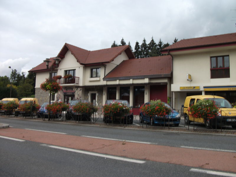
The church of Saint Nicolas was built in the 12th century in the Romanesque style and enlarged in the 16th century. Remnants of the former ramparts of Haute Bonne are obtained. The patch shows various characteristic houses from the 16th to 19th centuries. In the area there are several stately homes, including the Château d' Orlyé, the Château de la Charniaz and the Château de Loëx. The former parish church of Loëx brings medieval wall paintings.
Population
With 2907 inhabitants (as of 1 January 2011) Bonne is one of the medium-sized towns in the Haute-Savoie region. Since the early 1960s, a continuous increase in population was recorded. Outside the old village center caused to the promising slopes of Les Voirons numerous houses.
Economy and infrastructure
Bonne lived until well into the 20th century by small businesses. Agriculture also had an important meaning. Thanks to the proximity to major transport routes, there are now also several major companies, including construction and trading companies. Many working population commuters who engage in the larger towns in the area, especially in the Geneva - Annemasse, their work.
The place is a good infrastructure. It lies on the main road D907 which leads from Annemasse after Taninges. The nearest links to the A40 motorway is located at a distance of about 4 km. Further road links exist with Douvaine and La Roche- sur -Foron.


