Bonnefontaine
Bonnefontaine is a commune in the French department of Jura in the Franche -Comté. The municipality is the administrative seat of the Communauté de communes du Premier plateau.
Geography
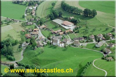
Bonnefontaine is located on 582 m above sea level. M., approximately 16 km east-northeast of the town of Lons -le- Saunier (air line). The farming village extends in the Jura, in the central part of the plateau Caledonia (first Jura plateau ), at the western foot of the Côte de l' Today.
The area of 8.80 km ² municipal area includes a portion of the French Jura. The main part of the territory occupied by the level of the plateau Caledonia, the average at 560 m above sea level. M. lies and partly of arable and meadow land, part of the forest ( Bois du Bois du Chanay and Fuatelet ) is passed. The plateau has no above-ground rivers, because the rainwater seeps into the karst underground. To the east, the municipality's area extends over a relatively steep slope down to the wooded crest of the Côte de l' Today, which separates the plateau from the eastern Ain Valley. On the ridge is 745 m above sea level. M. reached the highest elevation of Bonnefontaine.
At the hamlet of Le Bonnefontaine Patouillet part ( 577 m above sea level. M. ) on the plateau at the western foot of the Côte de l' Today. Neighboring communities of Bonnefontaine are Fay -en -Montagne and Picarreau in the north, Crotenay and Pont -du- Navoy in the east, the south and La Marre Mirebel in the West.
History
The municipal area of Bonnefontaine traces of a settlement site of the Iron Age have been found. Is first mentioned the town in the 12th century. Together with the Franche -Comté reached the village with the Peace of Nijmegen in 1678 to France. Until 1897, the community was called Les faïsses (derived from the Latin word for beech Fagus ), after which it was renamed in Bonnefontaine (similar to the well).
Attractions
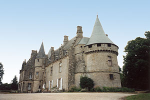
The village church of Notre-Dame was built on the site of a previous medieval building from 1486. In the 18th century, two side chapels and the current bell tower were added. Bonnefontaine has in the other a mansion and several farmhouses in the traditional style of the 17th to the 19th century.
Population
With 96 inhabitants (as of 1 January 2011) Bonnefontaine one of the smallest towns in the Jura. After the population had decreased significantly in the first half of the 20th century (1896 206 persons were still counted ), only relatively small fluctuations were recorded since the mid- 1970s.
Economy and infrastructure
Bonnefontaine was until well into the 20th century a predominantly coined by agriculture and forestry village. In addition, there are today some of the local small business enterprises. Meanwhile, the village has also changed into a residential community. Many workers are commuters who engage in the larger towns in the vicinity of their work.
The village is located off the major thoroughfares on a secondary road that leads from Mirebel by Fay -en- Montagne. Further road links exist with La Marre, Picarreau and Besain.


