Borden-System
The Borden system, or Système Borden Borden or system, is a procedure that can be uniquely identified with the archaeological sites in Canada and at the same time locates. It is basic hand tools for every student of archeology. It is named after its creator Charles Edward Borden, who in 1952 developed it together with Wilson Duff at the University of British Columbia.
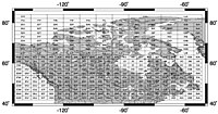
The Borden system is based on a classification throughout Canada in a grid that is based on longitude and latitude. It consists of four letters and at least one digit.
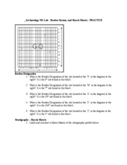
The first character is a capital letter which designates one of the surfaces, each comprising two latitudes. They are referred to from south to north with consecutive letters ranging from A to U. The second character is a lowercase letter, the refined this system. They range from a to l and include 10 minutes each, also from south to north.
Similarly, one travels from east to west with the third character, in turn, a capital letter (A to W ) comprising four degrees of longitude. Again followed by a lowercase letter, each of which represents again 10 minutes from East to West.
Large mesh this grid, however, is north of the 62nd parallel, there has 8 instead of 4 degrees of longitude, or 20 minutes each. This is a pragmatic convention to the fact that the foursquare from south to north are getting smaller, the more one approaches the North Pole.
The term within the Borden system for the Charlie Lake Cave is for example HbRf 39 The letters are used for localization in said grid, the number is the 39th locality in place so designated. The 39 refers to the time sequence of the detection.
To determine a single artefact, the system is also suitable. This is called the archaeological site designation, in this case HbRf 39, and hangs after a colon with no spaces to the number of the lost object.
In the United States, developed in the 1930s by the Smithsonian Institution system of the Smithsonian trinomial is used for the same purpose.


