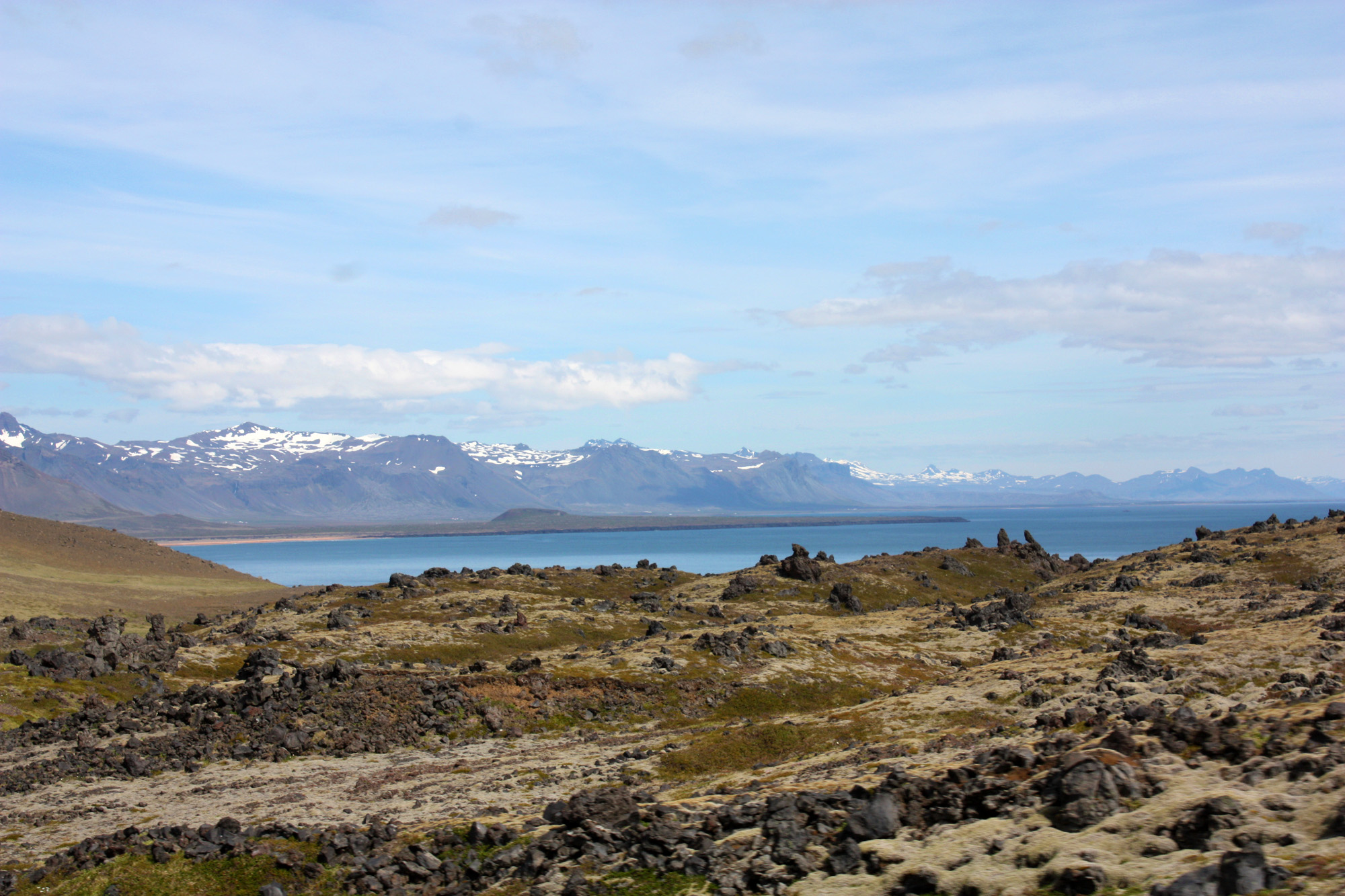
Breiðafjörður
The Breiðafjörður is a very broad fjord in west Iceland. It separates the Westfjords region (West Fjords ) of the Snæfellsnes peninsula.
Name
From Snæfellsnes one can on a clear day to see the skyline of the West Fjords, for example Grundarfjörður from that distance is across at the widest point as high as 40 kilometers.
Hence the fjord takes its name: German Broad Fjord.
From the small seaside village of Stykkishólmur is a ferry in the Westfjords.
Landscape
The landscape in and around the fjord has many special features to have as silt zones, small side fjords, islets and skerries, and hot springs in the tidal range in the islands.
About half of the tidal area of Iceland is here and the tidal range can reach 6 m. Between some islands formed at the onset of low tide is a veritable waterfall, and you have been thinking to install such as the La Rance tidal power plant in France here power plants.
Geology: Volcanism
The bedrock in the area was formed by the volcanic activity in the rift zone in the late Tertiary.
The rift zone drew some 14 million years ago, just above and to the West Fjords up, then she lay until about 7 million years ago on the east side of Breiðafjörður. As with other parts of Iceland is a structure mainly made of basalt layers that were deeply abraded during the Ice Age glaciers.
Today, some low-temperature areas with hot springs found in the area of the fjord, in part, on the islands and in some cases also in the sea, where they are visible at low tide.
Plants and Animals
The large tidal zone has a significant biological diversity as well as boast a particularly large single copies. One can find, for example, seaweed forests and other important habitats of fish and shellfish. In the area grow 230 species of higher plants and about 50 species of breeding birds. Among the latter are, for example, the fulmar, cormorant, white-tailed eagle, the eider duck, shags, puffins and the Red Phalarope. The Shelduck and Knuttstrandläufer keep here on also.
Finally, one finds in the fjord and islands the Commons seal and ringed seal. In the sea, various whale species to keep, such as the white-beaked dolphin or killer whale and the minke whale.
Economy and the Environment
The fishing, tourism and the harvesting algae, like the sheep important sources of income.
The Breiðafjörður is spawning ground for some of Iceland's most important farmed fish species.
Transport and Traffic
Baldur ferry crosses the fjord of Stykkishólmur in about 3 hours. On the south coast of the Westfjords it invests in Brjánslækur at Flókalundur. From there you can, for example, to the bird cliffs Látrabjarg ride (round trip about 5 hours ) or over the mountains of Glama after Isafjordur.
When permitted by weather conditions, you can also drive the coast to the east of Snæfellsnes north along drive up on Hvammsfjörður (Eng. trough Fjord ), the narrowest end of the fjord, along and in the region of the Westfjords, which limits the fjord in the north. The south coast of the Westfjords ( Barðarströnd ) on Breiðafjörður is largely uninhabited, but due to some extinct volcanoes of Central significant beauty.
Culture and history
The fjord and its surroundings were in earlier times, actually, from the conquest in the 9th century to the 19th century when wealthy area. Not by chance one of the richest men lived in the early Middle Ages to the Reykhólar on the Reykjanes Peninsula. With him about the legendary figure Grettir the Strong should have halted the winter.
Significantly, the island Flatey. On it was in the Middle Ages, an abbey of Augustinian canons. However, it was not she who wrote the famous Manuscript Flateyjarbók. It has been kept for centuries in Flatey.
The island was for centuries an important trading center.
Islands
There are three things in the Icelandic landscape, which are considered uncountable: the lakes of Arnarvatnsheiði, the mound in Vatnsdalur and the islands in Breiðafjörður. Their number is estimated at about 3,000.
These islands were inhabited in ancient times sometimes over centuries. Today, all are abandoned except for one. On some islands still are summer homes, others are availed to eiderdown production or as summer pastures.
The most important and only remaining continuously inhabited island is Flatey. She can be reached in summer by ferry.
The highest of the islands, Klakkseyjar, reaching a height of 95m.
Other island groups or islands are:
- Skáleyjar
- Hvallátur
- Svefneyjar
- Sviðnur
- Hergilsey
Side fjords of Breiðafjörður
Southern side fjords, that is, Fjords that extend after Snæfellsnes, are ( vWnO ): Grundarfjörður Kólgrafafjörður, Urhvalafjörður, Seljafjörður, Hraunsfjörður, Álftafjörður.
In the innermost, that is, easternmost part of the Breiðafjörður are ( vSnN ): Hvammsfjörður, Gilsfjörður, Króksfjörður, and Berufjörður Þorskafjörður.
In the southern Westfjords then are the side fjords ( vOnW ): Djúpifjörður, Gufufjörður, Kollafjörður, Kvígindisfjörður, Skálmarfjörður, Vattafjörður, Kerlingarfjörður, Mjóifjörður, Kjálkarfjörður, Vatnsfjörður.

_Iceland_M74A1908.jpg)

_Iceland_M74A1913.jpg)

_Iceland_M74A1901.jpg)


