Burmerange
49.4847222222226.3216666666667Koordinaten: 49 ° 29 ' 5 " N, 6 ° 19' 18" O
Location of Bürmeringen in the district Grevenmacher
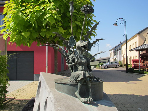
Wash fountain in Bürmeringen
Bürmeringen ( Lux Boermereng, French Burmerange ) is a town in the commune of Schengen in Luxembourg. By the end of 2011 Burmerange was the chief town of the same name, which belonged to the canton of Remich. The municipality was merged Burmerange November 23, 2011, the municipalities wave stone and Schengen to a new community, which was named Schengen.
A few figures
- Population: 1991: 522
- 2002: 960 of which 196 foreigners ( = 21 %)
- Total Area: 13.80 km ² Area of the community forests: 0,63 km ²
- The utilized agricultural area: 11,21 km ²
- Companies: 17 Agricultural holdings: 16
Approximately 80 percent of the active population work outside the community.
History
Boermereng was first mentioned in a charter of 842 by Emperor Lothair I as Boinbringas. Elweng 739 was called for the first time as Aigevingen. Éimereng 907 called for the first time as Ombringas.
(Eg Remich, Welleschten and Riemeschen ) what ( alternately under the Spanish, French and österreichschicher rule ) exists between 1659 and 1769 under French rule ( with, among others Mondorf, Duelem and Bous ) in contrast to the rest of the country as the Duchy of Luxembourg has.
Composition of the previous community
The municipality comprises the towns of:
- Burmerange,
- Elvange,
- Emerange.


