Cape Bojador
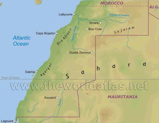
The Cape Bojador (Arabic رأس بوجادور, DMG Ra ʾ s Būyadūr, French spelling Cape Boujdour ) is a promontory on the northwest coast of Africa, south of the Canary Islands and is part of the present-day Western Sahara. The Cape Bojador forms the western foothills of the mountain Jebel el Aswad in the Sahara and was for a long time in the Middle Ages as the western end of the world. Here are the up to 130 meters highest known dunes ( Erg ) on the other consisting of Hammada flat coastal plain.
Especially the Portuguese under Prince Henry the Navigator had set itself the goal to overcome on their travels to the African coast south along the Cape. The Umsegelungen the Cape by other sailors as the Genoese Ugolino and Vadino (Guido ) 1291 Vivaldi or the Catalans Jayme Ferrer 1346 were either been kept strictly secret and / or forgotten. In addition, many expeditions such as the Vivaldi brothers never returned.
1422 commissioned Henry the Navigator for the first time a fleet to sail around Cape Bojador, but the captains returned out of fear for. Each year thereafter, this experiment was repeated at least once a year.
As the Portuguese Gil Eanes 1434 the Cape Bojador circumnavigated as Cape of Secrets, Cape Fear or Cape known of no return, the Portuguese had tried since 1422 15 times. Eanes therefore does not apply to unjust than he who navigator who opened the door to the route to India around Africa to the Europeans. To demonstrate its discovery, says a legend, he brought Henry the first "Rose of Saint Mary " with. This is likely to occurring in desert areas "Rose of Jericho ".
After disputes between the Portuguese and Spaniards over the ownership rights on the Atlantic coast, said the Pope in 1456 the Portuguese traders the country south, the Spanish north of Cape Bojador to. The first trading post south of the cape was built around this time in Arguin. 1884 declared the Spaniards, the area between Cape Bojador and La Gouira protectorate Spanish Sahara.
Because of the small depth of the lake, the numerous cliffs and sand banks, the strong currents and because of the frequent opacity of the atmosphere, the coast is dangerous to drive from the Cape to the south.
Some historians go after the study period maps, however, believe that it could have been in the late Middle Ages regarded as the " end of the world " "Cape Boujdour " around present-day Cape Juby in Tarfaya in the amount of the Canary Islands.


