Catanduanes
Catanduanes (Filipino: Katandwanes ) is an island province in the east of the Philippines, with the capital Virac.
It has 246,300 inhabitants ( census May 1, 2010 ) and an area of 1492.16 km ².
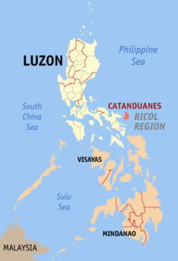
The island is located east of the Philippine main island of Luzon, in front of the Caramoan Peninsula. To the west it borders the Maquela channel, on the southwest by the Gulf of Lagonoy, in the north and east by the Philippine Sea.
You are expected to Luzon Island Group and belongs to Bicol region.
The tropical climate knows the beginning of the rainy monsoon and mid-year dry monsoon winds. In the center of the island is the 427.78 km ² Catanduanes Watershed Forest Reserve.
History
1573 reached the Spaniard Juan de Salcedo, the island, they were on the hunt for pirates, and conquered the inhabitants.
From 1600 worked Catholic missionaries on the island. After the annexation of the Philippines by the Americans arrived on the island in the 1930s uprisings against the new rulers. In the 2nd World War, the Japanese occupied the Philippines in 1942 with the Catanduanes. There was a regional resistance, succeeded after years of fighting in February 1945, to overcome the Japanese occupiers.
With the enactment of Commonwealth Act No.. 687 on October 16, 1945 Catanduanes became independent from the province of Albay and forms since then with some further, but very small islands own province.
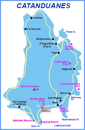
Municipalities
- Bagamanoc
- Baras
- Bato
- Caramoran
- Gigmoto
- Pandan
- Panganiban ( Payo )
- San Andres ( Calolbon )
- San Miguel
- Viga
- Virac


