Challes-la-Montagne
Challes -la -Montagne is a commune in the French department of Ain , in the Rhône -Alpes.
Geography
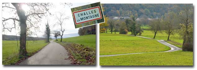
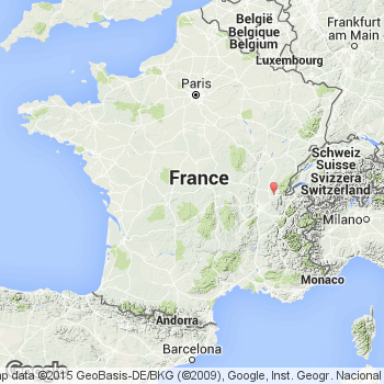
Challes -la -Montagne is located on 497 m above sea level. Level, about 20 kilometers east of the city of Bourg -en- Bresse ( straight line ) in the southern French Jura Mountains. The area of 7.65 km2 municipal area comprises part of the Montagne de Berthiand, a ridge ( anticline ) in the Bugey with an undulating plateau between the Ain valley and the valley of Oignin. Here, gentle hills and troughs alternate with elongated ridges from. Despite a slight relief structure, the municipality no above-ground rivers, because the rainwater seeps immediately in the porous limestone substrate. The western edge of the town follows the terrain edge, behind which begins about 200 m incised gorge of the Ain.
Apart from the actual town of Challes are still the two hamlets Cizod and Samériat to the community. They are located southwest of Challes on the same plateau. Neighboring communities of Challes -la -Montagne are Serrières -sur- Ain and Leyssard in the north, Ceignes in the east, Saint -Alban in the south and Poncin in the West.
History
The communal land of Challes -la -Montagne was among the possessions of the lords of Poncin and Cerdon that only came under the Count of Coligny and then the Thoire -Villars in the 12th and 13th centuries. In the 13th century the village Challes and Cizod are first mentioned. In the 14th century it came under the suzerainty of the Counts of Savoy, and with the Treaty of Lyon in 1601 she came to France. Originally only " Challes " referred to community gave in 2006 the present name " Challes -la -Montagne ".
Population
With 175 inhabitants (as of 1 January 2011) Challes -la -Montagne is one of the small communities of the department of Ain. After the population had decreased slightly in the first half of the 20th century (1901 350 people were still counted ), it varies from the beginning of the 1990s to today's value.
Economy and infrastructure
Challes -la -Montagne was until well into the 20th century a predominantly coined by agriculture, especially dairy farming and animal husbandry, and forestry village. Of the 22 small companies (as of 2010 ), about half are still agriculturally today. The remaining workers are largely commuters who engage in the larger towns in the vicinity of their work.
The small secondary road D85 connects the municipality with Poncin and the connecting road between D1084 Bourg -en- Bresse and Nantua. The A40 motorway runs along the southern boundary of the municipality, the next port is, however, only 12 kilometers away in Saint -Martin- du- Frêne.


