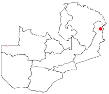
Chama, Zambia
Chama is a rural village in the east of the province Much Inga in Zambia. It is located 1,245 meters above sea level and is the seat of the administration of the district of the same with 96,000 inhabitants ( 2005). The town is located 150 kilometers north of Lundazi and south of Isoka close to the border with Malawi on the paved road between the two cities.
Economy
Chama is a rural and poor district. Agriculture is the supporting sector. Staple crop is rice (400 t in 2004), followed by millet, maize, cassava and beans, chickpeas, peas, cotton, peanuts. Since the collapse of state cooperatives marketing is a problem because of transport are lacking. The precipitates are good.
Infrastructure
There is a paved road Chipata - Isoka on Tanzam Highway, making a remote connection. The most important section is the after Isoka. An asphalt road to Mpika is planned. The other way in the district are is only accessible by four-wheel drive. There is a new hospital, since 2005, new primary and secondary schools with boarding facilities, 99 wells for drinking water supply and more are planned. Enough electricity in the province so far only to Nyimba, but is planned on Chama to the connection to the network of Malawi.
Others
Other places named Chama there is on the southern west bank of the Bangweulusees, just north of Samfya, and halfway between Bangweulusee and Mweru - Wantipa Lake.


