Champagnole
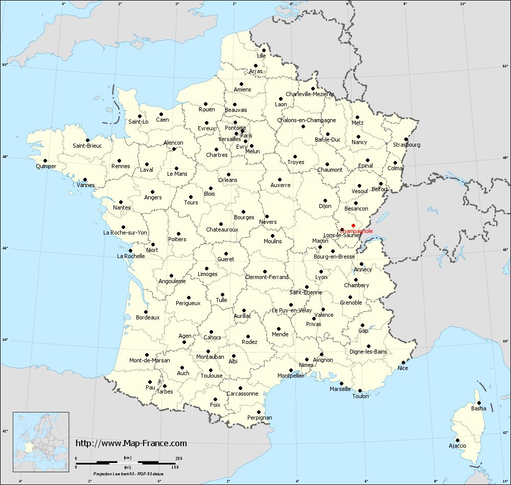
Champagnole is a municipality and industrial town in the French department of Jura in the Franche -Comté. It is the capital of the canton in the Arrondissement Champagnole Lons -le- Saunier.
Geography
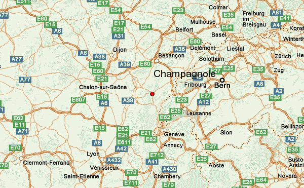
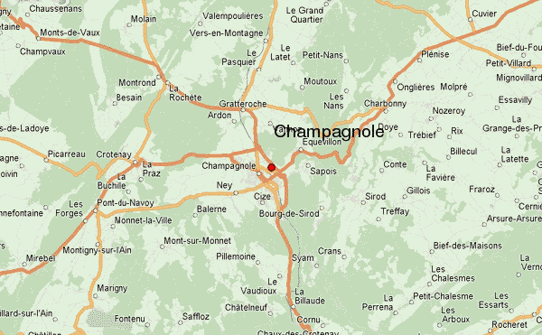
Champagnole is on 538 m above sea level. M., 28 km east-northeast of the town of Lons -le- Saunier and 60 km south of Besançon ( straight line ). The city extends in the Jura, in a plane which is drained by the Ain, at the southern foot of Mont Rivel and north of the high plateau of Champagnole.
The area of 20.18 km ² municipal area includes a portion of the French Jura. The central part of the area occupied by the level of Champagnole that average to 540 m above sea level. M. lies. In this level the tortuous course of the river Ain with a 20 to 40 m deep and is sunk up to 500 m wide valley. In Champagnole flows from the right Loudaine. With the exception of a small area near the center, the southern border is always along the Ain. To the west of the church floor with a narrow strip extends over the plain to the Bois de la Lette mass (570 m above sea level. M. ), in which case the northern border is formed by another right tributary of the Ain, the Angillon.
In the north the municipality area reaches to the freestanding mountain Mont Rivel, on 783 m above sea level. M. the highest elevation reached by Champagnole. To the east and southeast, the area extends into the expanded Grove Bois de Sapois (up to 730 m above sea level. M. ) and along the Ain to the mouth of the Saine at the industry works by Syam.
Neighboring communities of Champagnole are Montrond, Ardon, Vannoz and Équevillon in the north, Sapois and Bourg -de- Sirod in the east, Syam, Cize and Ney in the south and Monnet -la -Ville, Pont -du- Navoy and Crotenay in the West.
History
Based on various findings on the corridor En Curtil could be demonstrated that the municipality of Champagnole was already inhabited during the Roman period. First mentioned is the place in the 10th century under the name of Campagnola. The place name derives from the Latin word Campaniola, the diminutive form of campania (flat land, level).
Since the Middle Ages Champagnole belonged to the rule Montrivel, which was under the suzerainty of the lords of Chalon- Arlay. In 1320 it received from the ruling family of the city right awarded. At that time it was the site of a hospital for incurables, and a hospital. In the late Middle Ages Champagnole was destroyed several times by wars or fires. 1479 was the location of Franche -Comté town troops of King Louis XI. pillaged, 1580 ravaged by fire, 1633, drawn up in 1636 by plague affected and in 1637, destroyed by troops of Henri II d' Orleans, Duke of Longueville. Together with the Franche -Comté Champagnole came with the Peace of Nijmegen in 1678 to France. Due to a major fire in 1798, the town was largely destroyed. The reconstruction was carried out in the following years according to strict geometric principle with straight and usually at right angles intersecting streets. Since the beginning of the 19th century Champagnole developed into an industrial site.
Attractions
The parish church of Saint- Cyr -et -Sainte- Julitte was built in 1750 and has a tower with its onion dome. The church is distinguished by a rich interior, including a Baroque altar from the early 17th century (acquired from the Ursuline convent in Poligny ) and an organ of Marin Carouge ( 1721 ) from the Jacobins church in Poligny. Among the important secular buildings include the Hôtel de Ville (City Hall), built in 1830 in neo-classical style and has a remarkable staircase and beautiful rooms, as well as the Château d' Eau, which was built as a watch tower and water storage after the fire of 1798 and later, the population served as a clock tower. About the Ain of the Pont de l' Epée lead ( in the 18th century on the site of a Roman bridge built ) and the Pont Neuf ( 1841 ). On the Mont Rivel foundations of a Gallo-Roman temple are preserved. In the Archaeological Museum of Champagnole objects are shown, which were (among other things on the Mont Rivel ) promoted at various excavations 1965-1992 in the surrounding region revealed.
Population
With 8058 inhabitants (as of 1 January 2011) Champagnole one of the larger towns in the Jura. Strong growth rates exhibited Champagnole at the time of his industrialization in the first half of the 19th century. Thereafter, the population over a long period remained relatively constant, again there was a slow but steady increase until 1920. A renewed growth spurt followed in the period from about 1950 to 1970 in which doubled the number of inhabitants. The previous high was reached in mid -1970s, with about 10,300 inhabitants. Due to company closures and job losses took the population of Champagnole since then continuously. Overall, a decline of almost 20 % was recorded.
Economy
Champagnole has long been an embossed by the trade in agricultural products around town. Along the course of the River Ain settled early operations, which were dependent on hydropower, including mills and sawmills. So were the woodworking, making furniture and toys as well as the wood carving from the 18th century to the Public Sector. With industrialization in the early 19th century came to the traditional industries added a cement plant, a steel plant, the watch and the textile industry.
Today Champagnole is an important industrial town in the Jura. The larger industrial and commercial zones focus on the area between the railway line and the ring road to the north and east of the center. The major industries are now among the wood industry, furniture production, the production of bathroom equipment, the optical industry, an iron and steel plant, an aluminum foundry, manufacturing of watches accessories, printers, micromechanics and the transport industry. For a long time important factories such as the cement factory and the Toy Factory Jouef prepared their operation at the end of the 20th century.
In other Champagnole fulfills its central place function for a large region of the western Jura plateau. It is the location of numerous retail shops, various shopping centers, commercial firms (including those for computer science ), insurance and banking companies and has a hospital. In Champagnole all stages of compulsory education can be visited. For the higher education a public and a private school and a vocational school are available.
Traffic
The city is easily accessible via. It forms a road junction on the main road N5, which runs from Geneva via Champagnole to Dole. Other regional road links exist with Lons- le -Saunier, Salins- les- Bains and Pontarlier. The center is now relieved by a bypass road from transit traffic. The nearest links to the motorway A39 (Dijon - Bourg -en- Bresse ) is located at a distance of around 35 km. Champagnole has a station on the railway line, which serves the route of Andelot -en- Montagne to Morez. There are direct trains to Dole and Saint -Claude.
The airfield Champagnole - Crotenay ( grass runway ) is located approximately 10 kilometers west of the city at Crotenay.
Partnerships
- Dukinfield United Kingdom (Great Britain)
- Gottmadingen Germany (Baden- Württemberg)
- Varedo Italy (Monza and Brianza)


