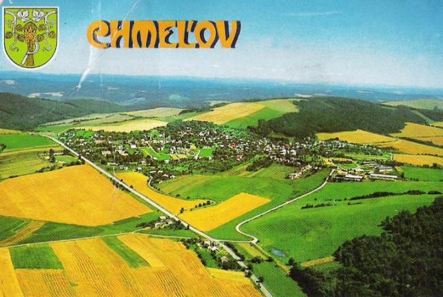
Chmeľov
Chmeľov ( until 1927 slovak also " Chomeľov "; Hungarian Komlóskeresztes ) is a municipality in eastern Slovakia with 969 inhabitants (as at 31 December 2011) in Okres Prešov, a part of the Prešov Region and is the traditional landscape Saris counted.
Geography
The municipality is located on the southern edge of the Low Beskid on the watershed between the catchment areas of Topľa and Sekčov. The 12.6 km ² municipal area is hilly and largely deforested. The center is located at an altitude of 375 m nm and is 19 km from Prešov away.
Administratively divided the community into the church and parts Chmeľov Podhrabina.
History
The town was first mentioned in writing in 1212, 1264 is the name Comlouch recorded. At this time there was a monastery of the Order of the Holy grave. In the 14th century Chmeľov belonged to Aba and its heirs. After a tax register of 1427, a tax of 42 Porta was due. After that, the village belonged various nobles. 1828 there were 34 houses in the village and 249 inhabitants.
Until 1918, belonged to the county located in the Saddle Rosh place the Kingdom of Hungary and was then Czechoslovakia and Slovakia today. To date, the village retains agricultural character.
Population
Results of the census 2001 (913 inhabitants):
After Ethnicity:
- 96.60% Slovaks
- 2.85% Roma
- 0.33% Czechs
- 0.11% Rusyns
After Confession:
- 49.62 % Roman Catholic
- 42.83 % Evangelical
- 5.48% Greek Catholic
- 0.88% no religious affiliation
- 0.55 % no answer
Structures
- Evangelical Church, built around 1300 and built in 1634 at the Renaissance Tower
- Country palace with a garden


