Mae Sai District
Amphoe Mae Sai ( in Thai: อำเภอ แม่สาย ) is the northernmost district ( Amphoe ) of Chiang Rai Province in northern Thailand. The capital of the district of Mae Sai Mae Sai is also called.
Geography
Mae Sai is located about 62 kilometers north of the provincial capital of Chiang Rai.
In the western part of the district there are numerous mountains, of which the most important is the Doi Tung. Is the Wat Phra That Doi Tung temple on its top.
Traffic
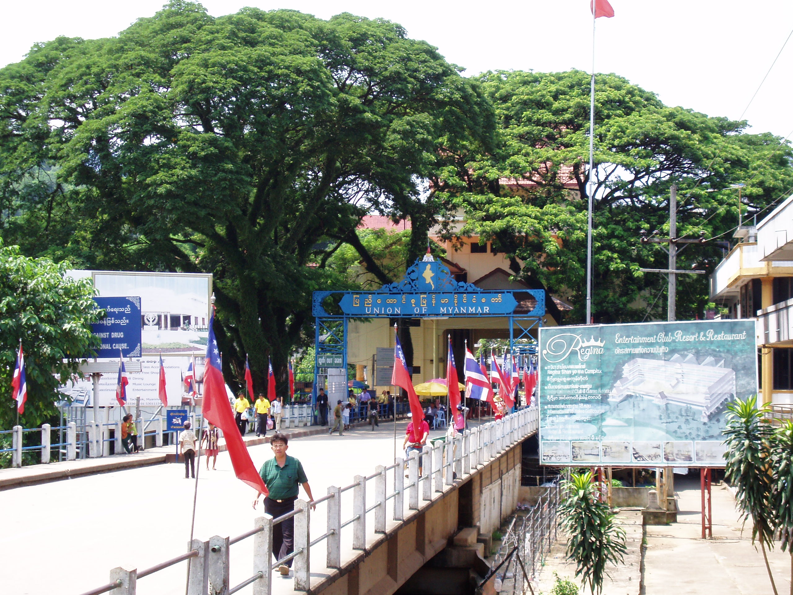
In Amphoe Mae Sai is the main border crossing from Thailand to Myanmar, where the Asian Highway AH2 ( Thai Highway 1 or Thanon Phahonyothin ) crosses the Maenam Mae Sai to Tachilek town in Myanmar.
History
Mae Sai was born on March 1, 1939 initially as a sub-district ( King Amphoe ) was established by the Tambon Mae Sai and Pong Pha district of Chiang Saen were separated. On 1 May 1950 he was raised to the full Amphoe status.
Management
The district is divided into eight municipalities ( tambon) divided, in turn, in 92 villages ( Muban ) are divided.
There are three small towns ( thesaban tambon) in the district:
- Mae Sai itself ( Thai: เทศบาล ตำบล แม่สาย ) consists of parts of tambon Wiang Phang Kham Mae Sai and,
- Huai Khrai ( Thai: เทศบาล ตำบล ห้วย ไคร้ ) consists of parts of the tambon Huai Khrai,
- Wiang Phang Kham ( Thai: เทศบาล ตำบล เวียง พา ง คำ ) also consists of parts of the tambon Wiang Phang Kham.
There are also eight - Tambon administrative organizations ( " Tambon Administrative Organizations" - TAO, Thai: องค์การ บริหาร ส่วน ตำบล ).
Note: The geocode 7 is not used.


.png)


