Ochsenälpeleskopf
Ochsenälpeleskopf east side (of the Hirschwängalm off)
Top of Ochsenälpeleskopf of the southern flank of
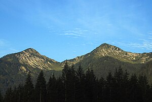
Phillips (left) and Ochsenälpeleskopf (photographed by the Ammer forest road ) bdep2
The Ochsenälpeleskopf is a mountain on the German- Austrian border in the Oberammergau Alps (Northern Calcareous Alps ). On Austrian Maps of the summit Hirschfäng or Älpeleskopf is called. The corresponding, deeper Ochsenälpele is 1778 m high.
Geography
The height of the summit is 1905 m. It can be climbed from both Austrian and German side. It has a great view of my feet, Säuling, the High Straußberg and the Zugspitze Mountains from the summit. Another adjacent peaks to the south is the crosshead (1909 m), which is directly across the Kuhkarjoch is achievable.
On the western edge of the Ochsenälpeleskopf 2002 and 2003 fragments of the meteorite were found Neuschwanstein, which had fallen on April 6, 2002.
Ways
The easiest way to Ochsenälpeleskopf via the Ammer Forest Hotel and the Schützensteig to Ammerwald saddle. From there, a trail through the Hirschwängalm to the summit.
Sources and maps
- ADAC hiking & cycling map sheet 55: Fussen, half Lech, Schwangau, Western Ammer Mountains, hiking map 1:30,000
- Compass (No. 4): Fussen, Ausserfern, hiking map 1:50,000


