Casselton, North Dakota
Cass County
38-12700
Casselton is a small town ( with a status of "City" ) in Cass County in the U.S. state of North Dakota. In 2010, Casselton had 2329 inhabitants.
Casselton is part of the Fargo - Moorhead Metropolitan Area.
Geography
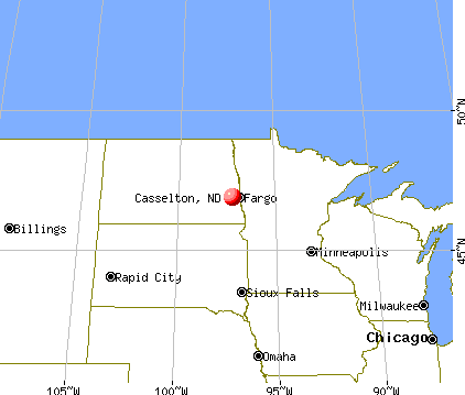
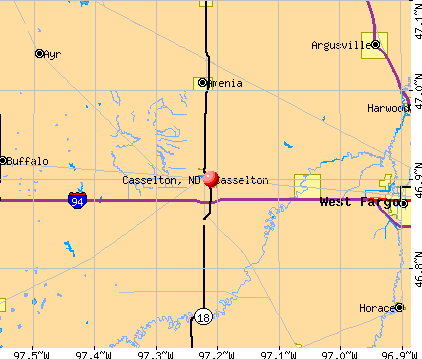
Casselton is located in southeastern North Dakota. A few miles east of Casselton flows of the Red River of the North, which forms the border with Minnesota. The geographical coordinates are 46 ° 54'02 Casselton " north latitude and 97 ° 12'40 " west longitude. The city covers an area of 4.92 km ².
The center of Fargo is located 35.2 km east. Other nearby towns of Casselton are Amenia (13 km north), Mapleton (14,4 km to the east), Leonard (29,3 km south) and Wheatland (11 miles west).
The nearest major cities are Winnipeg in the Canadian province of Manitoba (362 km north), Duluth, Minnesota on Lake Superior (430 km east), Minneapolis, Minnesota (410 km south-east ), Sioux Falls, South Dakota (420 km south) and North Dakota's capital city Bismarck (282 miles west).
The border with Canada is located 252 km north.
Traffic
Along the southern edge runs in east-west direction Interstate 94 The North Dakota Highway 18 runs north -south direction as the main road through the city of Casselton. All other roads are minor roads, some unpaved roadways and within local roads.
By Casselton runs in east-west direction, a railroad line of the BNSF Railway. About this route also operate passenger trains from Amtrak, which maintains a station in nearby Fargo. From the BNSF route branches off a branch line, which is operated by the Red River Valley and Western Railroad ( RRVW ). The RRVW is a regional railway company that operates freight traffic on land leased from the BNSF Railway tracks.
The Casselton Robert Miller Regional Airport is located 5.8 km south of a small airfield. The nearest major airport is the Hector International Airport in Fargo ( 37.7 km to the east).
Demographic data
According to the census in 2010 lived in Casselton 2329 people in 874 households. The population density was 473.4 inhabitants per square kilometer. In the 874 households lived statistically 2.66 per person.
The racial the population was composed of 97.3 percent White, 0.1 percent ( two) Black or African American, 0.9 percent Native American, 0.1 percent Asian and 0.4 percent from other ethnic groups; 1.2 percent were descended from two or more races. Regardless of ethnicity were 2.4 percent of the population are Hispanic or Latino of any race.
31.4 percent of the population were under 18 years old, 58.1 percent were between 18 and 64 and 10.5 percent were 65 years or older. 48.6 percent of the population was female.
The median annual income for a household was $ 55,972. The per capita income was $ 27,270. 2.4 percent of the population lived below the poverty line.
Railway accident in late 2013
On the afternoon of December 30, 2013 derailed west of Casselton wagons of a goods train BNSF Railway, which transported grain. A train on the adjacent track, transported the tank cars of crude oil in the opposite direction, drove into the derailed cars. A large fire started. Some exploded.
The disaster brings back memories of the railway accident of Lac- Mégantic (July 6, 2013, Canada).
The train tracks run through the town of Casselton. North Dakota is the state, is conveyed into the second most oil (after Texas). The "oil regulator" of North Dakota said shortly before the accident, about 60 percent of the oil produced will be transported by rail; this ratio will rise in 2014 to about 90 percent.
Memorable people
- Andrew H. Burke (1850-1918), second governor of North Dakota (1891-1893), lived for several years in Casselton
- Jack Dalrymple ( b. 1948 ), 32nd Governor of North Dakota ( since 2010), for many years lived in Casselton


