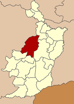
Lam Thamenchai District
Amphoe Lam Thamenchai ( Thai: อำเภอ ลำ ทะ เมน ชัย ) is a district ( Amphoe - administrative district ) in the province of Nakhon Ratchasima. The Nakhon Ratchasima province is located in the northeast region of Thailand, the so-called Isaan.
Geography
Amphoe Lam Thamenchai borders the following counties ( from east clockwise): Amphoe Khu Mueang on the Lam Plai Mat and the province of Buriram, as well as to the Chum Phuang and Mueang Yang in the province of Nakhon Ratchasima.
Lam Thamenchai is named after the Thamenchai River, the main river of the district.
History
Lam Thamenchai was on 15 July 1996, first as a small district ( King Amphoe ) was established by its territory was separated from the Chum Phuang.
On 15 May 2007, the Thai government had decided that all 81 King Amphoe to rise in the simple Amphoe status to unify the administration. With the publication in the Royal Gazette " Issue 124 chapter 46" of 24 August 2007, this decision officially entered into force.
Management
Amphoe Lam Thamenchai is divided into four subdistricts ( tambon), which in turn have together 59 municipalities ( Muban ).
There are two small towns ( thesaban tambon) in the district:
- Nong Bua Wong ( Thai: เทศบาล ตำบล หนองบัว วง ), consisting of parts of the tambon Kui and Phlai,
- Kui ( Thai: เทศบาล ตำบล ขุย ), consisting of other parts of the tambon Kui ..
There are also three administrative organizations ( " Tambon Administrative Organizations" - TAO, Thai: องค์การ บริหาร ส่วน ตำบล ).


