Le Chenit
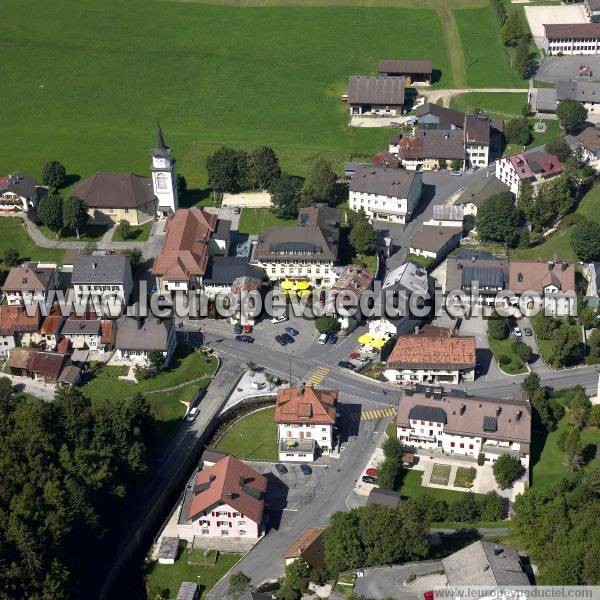
Church of Le Sentier
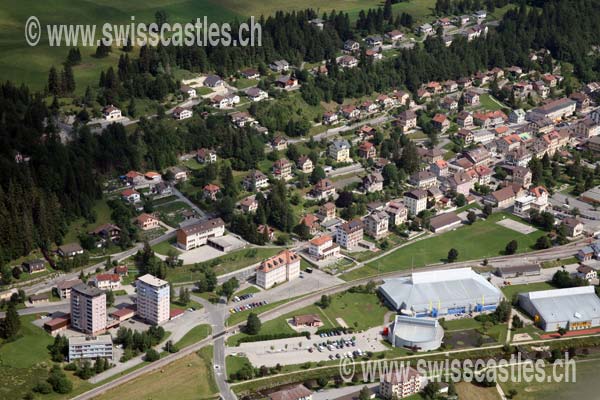
Le Chenit ( [ lə ʃ ( ə ) ni ], Provençal in the local dialect [( ao ) ʦənɛ ] ) is a municipality in the district of Jura-Nord Vaudois in the canton of Vaud in Switzerland.
Geography
The parish of Le Chenit lies on 1'013 meters above sea level. M., 37 km southwest of the district capital Yverdon -les -Bains, 32 km west-northwest of Lausanne ( straight line ). The municipality extends the Vallée de Joux at the Orbe, southwest of Lac de Joux in the Vaud Jura.
The area of 99.2 km ² large municipality area includes a portion of the Vaud Jura and the entire southwestern part of the ( Swiss ) Vallée de Joux. The central part of the area is the north-east directed from the southwest, about 1 km wide valley of the Orbe. The river has many meanders and flows below Le Sentier in the Lac de Joux, the most southwest part belongs to Le Chenit. North-west of the valley followed by a steeply rising terrain rib (up to 1,181 m above sea level. M. ), behind the sink Derrière la Côte and Le Sentier and finally the vast forest area of the Grand Risoux. The north-western border runs along the crest of the anticlines of Risoux about Roche Champion ( 1'327 m above sea level. M. ) and Mont Risoux ( 1,384 m above sea level. M. ). Southeast of the Orbetals the municipality extends to the Mont- Tendre chain. Parallel to the valley extend the heights of Vue de Genève ( 1'492 m above sea level. M. ), Grande Rolat ( 1'389 m above sea level. M. ) and Chaumilles ( 1,430 m above sea level. M. ). Adjoining to the Combe des Amburnex, existing from different wells valley floor. The southeastern border lies on the ridge of the Mont- Tendre - chain ( from southwest to northeast) Cret de la Neuve ( 1,495 m above sea level. M. ), crossing the pass Col du Marchairuz, the Monts de Bière ( 1,530 m above sea. M. ) and the Cunay that with 1'609 m above sea level. M. is the highest point of Le Chenit. The Mont- Tendre - chain is characterized by typical symptoms of the Karst, namely numerous aboveground endorheic depressions and sinkholes and karst fields and multiple cave systems. In this chain there are extensive Jura high grazing pastures with the typical tall spruce trees that are either individually or in groups. Large parts of the Jura mountains are located in the protected area of Vaud Jurassic Park. From the municipality surface 1997 3 % was attributable to settlements, 66 % of forest and shrubs, 29% to agriculture and slightly less than 2% was unproductive land.
Community structure
- Le Sentier, 1'013 m above sea level. M., left the Orbe; Administrative center of the municipality and capital of the district of La Vallee.
- Le Brassus, 1'033 m above sea level. M., on the same creek right of the Orbe, the starting point to the Col du Marchairuz.
- L' Orient, 1'021 m above sea level. M., a village street lines to the right of Orbe, across from Le Sentier.
Not the status of a fraction, but also has its own local government have:
- Le Sentier, 1'058 m above sea level. M., at the southeast foot of the Grand Risoux.
- Derrière la Côte, 1'076 m above sea level. M., in a valley at the southeast foot of the Grand Risoux.
In addition, there are numerous other settlements and hamlets:
- Rocheray, 1'006 m above sea level. M., on the western shore of the Lac de Joux.
- La Golisse, 1'015 m above sea level. M., southwest of Lac de Joux.
- La Brasserie, 1'065 m above sea level. M., at the edge of Risoux.
- Les Moulins, 1'010 m above sea level. M., on the right of Orbe in Le Sentier.
- Chez Villard, 1'028 m above sea level. M., on the right edge of the valley of the Orbe.
- Le Campe, 1'030 m above sea level. M., on the right edge of the valley of the Orbe.
- Chez le Maître, 1'020 m above sea level. M. at the left edge of the valley of the Orbe.
- Piguet lingerie, 1'023 m above sea level. M. at the left edge of the valley of the Orbe.
- Cret Meylan, 1'020 m above sea level. M., in Orbetal on the northern edge of Le Brassus.
- Chez Tribillet, 1'022 m above sea level. M., on the left of the Orbe, across from Le Brassus.
- Bas du Chenit, 1'054 m above sea level. M., along the road southwest of Le Brassus.
- Piguet -Dessus, 1,086 m above sea level. M., at the edge of Risoux.
In further include many individual farms which are scattered at the height of Mont- Tendre - chain and at the edge of Risoux to Le Chenit.
Neighboring communities of Le Chenit are Le Lieu, L' Abbaye, Mont Richer, Berolle, Bière, Gimel, Saint- George, Longirod, Marchissy, basins and Arzier in the Canton of Vaud and Bois- d'Amont Chapelle -des- Bois, Chaux -Neuve and Mouthe in neighboring France.
Population
With 4386 inhabitants ( 31 December 2012) Le Chenit belongs to the medium-sized municipalities in the canton of Vaud. Of the residents 88.6 % are French, 2.9 % Italian-speaking and German-speaking 2.5 % (as of 2000). The population of Le Chenit increased continuously until 1970. The impact of the economic crisis caused a sharp decline thereafter until 1980. Since then shuttled its population by 4300, before a further decrease occurred in recent years.
Economy
Early developed in Le Chenit only agriculture but also the artisanal and industrial activity. At the beginning of the development was the mid-16th century, the blast furnaces in Le Brassus, a glassworks in Pré- Rodet and saw mills, tanneries and mills. During the 18th century, these branches of industry were replaced by the watchmaking, which was first applied in homework, since the mid-19th century in factories. Due to the Great Depression in the 1930s Le Chenit has been hit hard, the number of unemployed rose temporarily to 10%. During the Second World War, was stabbed in the marshes along the Orbe peat. The crisis in watch industry in the mid -1970s triggered a massive exodus.
Today the population is employed in the watch industry, which specializes in the manufacture of quality watches (luxury watches and jewelery ), eg in the Manufacture Audemars Piguet. This includes the gemstone industry and other suppliers. More jobs are available in the electronic industry, precision mechanics, in sawmills and wood processing, tourism and the local industry. The Comptoir de la Vallee, a showcase of the Vallée de Joux since 1976 takes place every year in Le Chenit. Agriculture only has a low significance with livestock and dairy farming and cheese production.
Tourism
Towards the end of the 19th century evolved with the connection to the public transport, tourism in Le Chenit. A larger recovery but there was only since about 1970. Importantly especially winter tourism with some ski lifts in Le Brassus and L' Orient. The topography of the Jura mountains is ideal for cross-country skiing. In Le Brassus was 1930-2002 a ski jump, Nordic ski competitions followed international took place. The area of Le Chenit also serves in summer as a popular destination for hiking in the Jura hills or for water sports on the Lac de Joux.
Education and Culture
Le Sentier is home to several regional schools, including secondary school (since 1876) and a vocational school for watchmakers and micro mechanics (since 1902). Also, the District Hospital was established in 1934 and a large sports center are in this part of the community. In Le Sentier are a school museum and art gallery in 1982, launched L' essor.
Traffic
Le Chenit is on the main road from Vallorbe to La Cure. From Lake Geneva Le Brassus and Le Sentier can be reached via the Col du Marchairuz. On August 21, 1899, the company Chemin de fer Pont- Brassus took the railway line from Le Pont to Le Brassus in operation. Train stations or bus stops are available in Le Sentier, Chez le Maître, La Golisse and Rocheray. From Le Sentier is a bus line via L' Orient Le Pont and Le Brassus runs twice daily bus to Nyon.
History
The first mention of Le Chenit was in 1489 under the name quinitol as summer pasture. A permanent settlement there is probably only since about 1547. The entire area was under the 1536-1798 Bernese permanent dominion over the Vaud first to Kastlanei Les Clées under the bailiwick of Yverdon. In 1566 it came to the bailiwick Romainmôtier. It was not until 1646 formed Le Chenit after the separation of the Municipality of Le Lieu an independent municipality.
After the collapse of the ancien régime Le Chenit belonged from 1798 to 1803 during the Helvetic Republic to the canton of Geneva, who came up then with the enactment of the Act of Mediation in the canton of Vaud. 1798, the municipality was assigned to the district of La Vallee. Because of tensions and rivalries end of the 19th century within the community ( Grand Conseil ) were successively formed the three autonomous communities part on the decision of the Vaud Cantonal Parliament: Le Sentier (1900), L' Orient (1904) and Le Brassus (1908 ).
Attractions
In Le Sentier the first church was built in 1612. Today, Le Sentier has a reformed and a Catholic church. Also in Le Brassus are a reformed church ( built 1835-37 ) and a Catholic church, which dates from the late 19th century.
Personalities
French alpine skier Françoise Macchi was born in the village of Le Sentier. The cyclist, an aviation pioneer and entrepreneur Edmond Audemars (1882-1970) comes from the village of Le Brassus.


