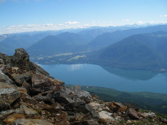
Arrow Lakes
The Arrow Lake is one arising on the construction of the Hugh Keenleyside Dam Lake in southern British Columbia, which is drained by the Columbia.
Location
The 232 km ( 145 miles ) long lake extends from Hugh Keenleyside Dam - about 10 km north- west of Castlegar built - almost to the Revelstoke Dam, which impounds the Columbia River a few kilometers north of Revelstoke to a reservoir. At high tide, the storage volume is 8.76 cubic kilometers, the height of the lake level fluctuates 419-440 meters above sea level, although at low tide the division of the lake, which existed before the construction of the dam is still visible.
The Upper Arrow Lake and Lower Arrow Lake, are separated by a narrow point, which is called the Narrows. The Upper Arrow Lake has a surface area of approximately 226.5 km ², of Lower Arrow Lake at low water has a surface area approximately 163.9 km ².
The location in a valley between the Monashee Mountains and the Selkirk Mountains dominating the landscape of sometimes only a few hundred meters wide lake, so that you will find on its shores only a few flat areas. Instead, the heavily wooded steep slopes of up to 2,600 m high mountain ranges fall over steep cliffs into the lake.
Three ferries connect various streets that run mostly densely along the shore:
- Shelter Bay - Galena (Highway 23 to Highway 23 and Highway 31 )
- Arrow Park - East Arrow Park ( Lower Mosquito Rd and Saddle Mountain Revelstoke Rd with Highway 6 )
- Needles - Fauquier (Highway 6 Highway 6 )
A continuous road link to both banks does not exist.
Keenleyside Dam
The dam - originally named High Arrow Dam - was built in 1968 as the Canadian contribution to the fulfillment of the Columbia River Treaty in January 1961. Originally intended only to control the outflow of the Columbia River, a hydroelectric plant was built with a capacity of 185 MW until 2002. Dam and power plant are operated by the company BC Hydro.


