Artlish Caves Provincial Park
IUCN Category II - National Park
Artlish River Cave
The Artlish Caves Provincial Park is a 285 -hectare Provincial Park on Vancouver Iceland in the Canadian province of British Columbia. The park is located in the north of the island in the Strathcona Regional District.
Plant
The park is not accessible by public roads. It is with him a so-called backcountry park. The park is located about 70 kilometers south-west of Woss and about 18 kilometers north of Zeballos. A gravel road passes in about 4 kilometers to the park. A logging road that approach led to the park, was closed in 2009.
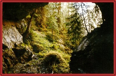
The park stretches along the Artlish River and a geological feature of the park provide its karst, caves and sinkholes represents the two largest caves Artlish River Cave and Black Hole Cave, have a length of 396 and 740 meters. These two are in the northwest parking area close to the river or in its vicinity. The Artlish River flows while also a part of the way completely through the Artlish River Cave. In terms of volume flow and the dimensions, it is currently the largest known and active river cave system in Canada. In addition to the large, there are also some smaller caves in the park.
The park is surrounded by the mountains of Vancouver to Iceland Ranges belonging, Haihte Range. At the eastern edge of the park is the 1521 m high peak Mook, while the park itself climbs up a not so high, the opposite mountain.
In the park is a protected area category II (National Park)
History
The park was established in 1996 and had at his institution already an area of 234 ha Over time it was expanded to its present size.
As with almost all provincial parks in British Columbia, however, also applies to this that he long before the area of immigrants settled or she was part of a park, they, in this case, the Kyuquot, was the hunting and settlement area of different strains of the First Nations. The name of the park was inspired by a group of Kyuquot back to the A'licath (in English: Artlish ). Also found in the park some Culturally Modified Trees.
About the caves in the park was the first time in 1932 by the Canadian Geological Survey, and reported in the period 1974-1978 they were then mapped. Before 1932 the caves only the resident First Nation, hunters and loggers were known.
Flora and Fauna
A forestry use to a greater extent also found in the park, before its establishment, instead. Therefore, no longer will also find a lot of primary forest. On trees we find here with the Sitka spruce also the Western Hemlock, the Giant Tree of Life and the purple - fir.
The detectable species correspond to the location of the park. In the area you will find, among others, the Black Bear, and here comes the Roosevelt elk before. The caves in the park also form a wintering area for several species of bats. The river provides habitat for sockeye salmon, silver salmon, king salmon, pink salmon and rainbow trout and steelhead.
Activities
The park has no tourist infrastructure. So-called backcountry camping is allowed, however.
The caves are the attraction of the park for tourism. There are professional guides for the caves. Due to the remoteness and inaccessibility, the number of visitors to the park itself holds but within limits.
Also can be driven on the River Artlish professionally canoe.


