Breitenbach (Echaz)
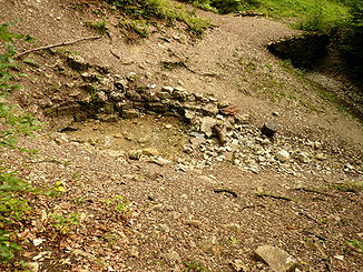
Breitenbach source
The Breitenbach in the district of Reutlingen, Baden-Württemberg is about 8.9 km long, south and orographic left tributary of the Echaz, which flows in the Reutlingen district Betzingen.
Source
The Breitenbach springs on the escarpment, the northwest steep slopes of the Swabian Alb. Its called as Breitenbach source Main source is less than 2 km northeast of Gönningen and 750 m (each crow flies) south of County Road 6729 on the north edge of the Pfullinger mountain, a northern spur of the Barm ( 736.5 m above sea level. NHN ), in a clearing in a little over 550 m above sea level. NHN. The source located under mighty talus is framed in an approximately 5 m² niche with natural stone and was designated a natural monument. Water runs at the higher layer boundary of the Lower Jurassic marl to well- Layered lime formation. About 20 m below the source grow by lime precipitation from the source water Kalksinterpolster. A little further south, so that above the main source, there is still a higher source to a little over 600 NHN Template: Height / unknown reference.
Course
Initially, the predominantly northward aspiring Breitenbach flows through the Selchental and remains in the woods, until he crosses the country road 383 above from Reutlingen to about half of its flow path. Then the now fringed by trees and bushes creek running into something western distance from the core city by Reutlinger agricultural corridor. Thereafter, he passes under the highway 28 in Reutlingen and Neckar -Alb -Bahn.
Mouth
The Breitenbach opens, fluent in his last few meters to the northwest, in the southern part of the district of Reutlingen Betzingen the cemetery in the Au in the coming there from east-southeast Neckar tributary Echaz.
Inflows and pond
Among the tributaries of the width of Bach and the still waters at and near the include Bach - ordered from source to mouth ( waters of higher order indented accordingly under its outfall waters lengths and surfaces after geodata viewer, heights in meters ( m) above mean sea level ( MSL ). mostly interpolated according to the contour image there):
- Ehrensbach, from right to below 510 m altitude just before the road from Pfullingen after Gönningen 0.8 km; occurs below 560 m above sea level on the northern slopes of the Gielsbergs
- Inflow, from left to Wolf hole height to over 450 m, 1.7 km; occurs at about 580 m above sea level at the northern foot of the Stöffelbergs with its castle ruins
- Breitwies Bach, m from right to below 440 level, 1.2 km; produced more than 500 m height on the Pfingstweide in the forest west of the Pfullinger Georgenhof
- Feeds a lake in a Tallichtung, 0.3 ha
- City Wiesbach, m from left to over 410 height, 1,2 km; produced more than 500 m height at the landfill during Käpfle
- Inflow from the Eichwald, from left to below 400 m height at the outlet in a southern corridor bay, 1,1 km; occurs at about 460 m altitude in the Oak Woods
- Flayer Bachgraben, right a few steps further, 1,5 km; occurs at about 510 m altitude in the forest just north of the Pentecostal pasture and passes through the vicious blade
- Feeds a pond in the middle of the hall bay, 2,2 ha
- Eichwäldlesgraben, from left to about 385 m altitude just before the L 383, 1.7 km Drained the landfill at Hofgut Old Castle
- Flayer clean ditch from the right just after the road, 1,0 km; occurs at about 430 m altitude in the forest Won Hohlicht Rain
- Schlattmann Wiesbach, from right to about 380 meters above sea level on the northern tip of the motor sport area, 2,2 km; occurs below 545 m altitude in Rötwald fed up at altitude 390 m, some ponds in the middle reaches of the south of the sports grounds around the stadium cross calibration, the largest 0.8 ha and 0.3 ha
- Shorter Quellast, from left to less than 430 m before the exit Forest, 0.9 km; occurs at about 470 m altitude in the forest near the Cross Stone Oak
- Inflow from the right at about 380 m altitude in the nature reserve Listhof, 0.7 km

.jpg/220px-Spring_of_the_Echaz_5_(aka).jpg)
.jpg)
