Cerna River (Danube)
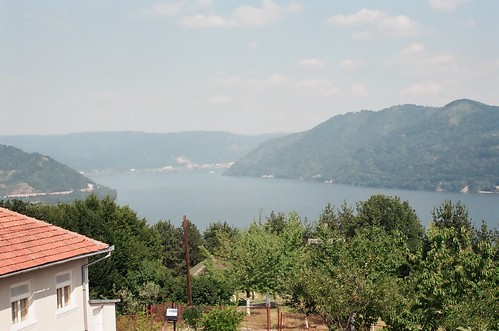
Mouth of the river Cerna in the Danube at Orşova
The Cerna (Hungarian Cserna ) is a left tributary of the Danube in Romania, which rises in Gorj county.
Your source is located on the southeast side of the Munţii Godeanu, then it moves in a southwesterly direction away and flows into the Danube Orşova. The upper part of the flow is also called Cernisoara. At a length of 84 km, it crosses a valley with numerous, sometimes very deep canyons. Before she crosses the Baths of Băile Herculane, it flows through the reservoir tierna. During the Habsburg monarchy, Cerna formed the eastern border of the state.
The Cerna Valley is unique in that it - completely enclosed by mountain regions - separates two different mountain ranges. It is a typical longitudinal valley which follows the tectonic line between the Valcan and the Mehedinţi Mountains, bounded on one side by the Godeanu massif and on the other side of the Cerna Mountains. The numerous endokarsten forms of national parks Domogled - Valea Cernei provide nationally and internationally exceptional scientific value dar.
References
- Administratia Nationalã Apelor novels - Cadastrul Apelor - Bucureşti
- Directiva Cadru 2000/60 a Uniunii Europene în Domeniul Apei - Judeţul Gorj
- Judeţul Gorj - Planul Judetean de Apārare împotriva Inundaţiilor
- Trasee turistic - Judeţul Caras
- Trasee turistic - Judeţul Gorj
- Trasee turistic - Judeţul Hunedoara
- Trasee turistic - Judeţul Mehedinţi

.JPG/256px-%2525C3%25258Endiguire_Cerna_(2).JPG)


