Charlotte Harbor (estuary)
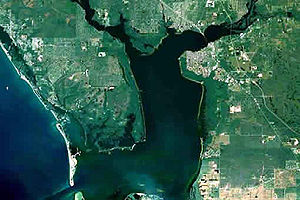
Charlotte Harbor, in the middle of Pine Iceland, left Gasparilla, La Costa and Sanibel Iceland
Charlotte Harbor is an estuary of the Gulf of Mexico on the west coast of the U.S. state of Florida. The 699 km ² bay is more than 48 km long, up to 12 km wide and covers 352 km of coastline. In the bay lead and other minor streams of the Myakka River, the Peace River and the Caloosahatchee River. The Intracoastal Waterway runs through the bay. For the Gulf of Mexico defines a series of islands and sandbanks, which Gasparilla Iceland, La Costa and Sanibel Iceland Iceland include the bay. Inside the flat, on average, only two meters deep bay is the island of Pine Iceland, situated on the coast cities North Port, Port Charlotte, Punta Gorda, Cape Coral and Fort Myers.
The Charlotte Harbor is known for its biodiversity. At the mouth of the tributaries there are extensive seagrass beds, mangrove swamps and wet meadows, so the area has a high ecological and fisheries represent a significant economic importance. Besides numerous other protected areas in the Charlotte Harbor Preserve State Park protects 170 sq km of the adjacent coastal areas with a total of 112 km of coastline.
The expansion of residential development due to the rapid population growth on the Gulf Coast and the increasing intensification of agriculture, in particular the Einschwemmung of phosphate due to over-fertilization, however, threaten the ecosystem. The Charlotte Harbor National Estuary Program, only one of three such projects in Florida, is to protect the water quality of the bay and the ecological diversity.


