Conway Reef
Template: Infobox Atoll / Maintenance / height Missing
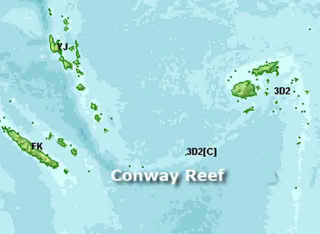
Ceva -i -Ra or Theva -i -Ra, (formerly Conway Reef and Conway Reef ), is an atoll coral reef shaped 450 km southwest of the Fiji Islands. Politically, it is part of the Republic of Fiji and is administratively attached to the province Nadroga - Navosa in the Western Division assigned.
Geography
The reef is 450 km far away from the actual Fiji Islands, otherwise a maximum of 75 km distance between neighboring islands have (apart from the Rotuma Islands, which, though also politically, but not geographically belong to the Fiji Islands). The closest island is the Hunter Island 270 km west-southwest, the politically belongs to New Caledonia, but is also claimed by Vanuatu. Ceva -i -Ra is from east to west 2.5 km long and one kilometer wide and occupies a total area of about two square kilometers, including lagoon and Riffkranz. In the middle of the reef there is a small sand island, 320 by 73 meters, with an area of about two hectares and a height of 2 m above the sea. The stranded wreck of a coaster is 240 meters south of the island, and a stranded fishing vessel lies on the northeastern end of the reef. A total of three shipwrecks lie on the reef, from the years 1979, 1981 and 2008. The last wreck was the Chinese fishing vessel Shin Sheng No. 165 The reef is uninhabited, except by sea birds that show little fear of people. The authorities of Fiji only be issued in exceptional cases, permission to visit in order to protect the reef. Try landing on the island of the reef should be made only at high tide in boats with shallow draft. Navigation between the corals requires extreme caution.
History
1838 took Royal Navy Captain Drinkwater Bethune HMS Conway note of the reef, but it was only years later mapped by the British, by Captain Denham of HMS Herald.
1983 some vegetation on the island was found, but no 1985. Currently, there are again some vegetation, about two meters high.


