Bowil
Bowiler Church
Bowil is a municipality in the Bern-Mittelland administrative district in the canton of Bern in Switzerland.
Geography
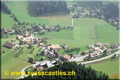
Bowil is located on 733 m above sea level. M., 6 km east and 20 km east-southeast of Konolfingen the city of Bern (air line). The farming village extends into the broad valley basin between the heights of Blasenflue in the north and the short hill to the south, exactly on the Talwasserscheide between the catchment areas of Chise (right tributary of the River Aare ), and the Emme.
The area of 14.7 km ² large municipality area includes a portion of the relatively strong in relief hill country between the Aare Valley and the Emmental. The central part of the area occupied by the 500 m to 1 km wide flat valley floor, which extends from west to east, ensuring an easy transition from Bern in the middle Emmental railway and road. The western part of this valley is drained by the Chise and their source Bach Dürrbach while the Schüpbach, which flows through the stone ditch, ensures drainage of the eastern part. The stone trench at the same time forms the eastern boundary of the municipality. North of this valley floor reaches the municipality spell over a steep slope down to the southern foothills of the Blasenflue ( Geiss in the forest 930 m above sea level. M. ) and in the Schwändigraben.
To the south of the municipality spell extends over a gently rising and subdivided by different source valleys of Dürr Bach slope up to the crest of the short mountain. Here the southern border runs through the forest heights of Ringgis ( with 1'183 m above sea level. M. the highest point of Bowil ), Müliseilewald ( 1,180 m above sea level. M. ) and Goucherewald (up to 1,100 m above sea level. M. ). From the municipality surface 1997 accounted for 5% on settlements, 39 % of forest and shrubs, 55 % to agriculture and slightly less than 1% was unproductive land.
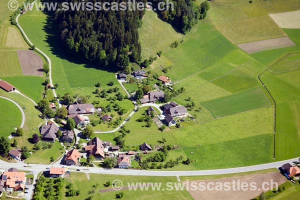
To Bowil include various hamlets, groups of farms and individual farms that are scattered on the Northern Slope of the short hill. Among the important hamlets and farm groups include:
- Rünkhofen (700 m above sea level. M. ) on the northern edge of the Chisetals, at the mouth of Schwändigrabens
- Oberhofen (703 m above sea level. M. ) in the valley at Bowil
- Hübeli (712 m above sea level. M. ) at the northern foot of the short hill and at the edge of the moss
- Stones ( 713 m above sea level. M. ) on Schüpbach, at the mouth of the stone trench in the valley
- Längeney (781 m above sea level. M. ) in Dürrbachtal south of Bowil
- Frieder Matt ( 825 m above sea level. M. ) in a basin of Dürr Bach between the heights of the short mountain
- Schwändimatt (813 m above sea level. M. ): a scenic location on the Northern Slope of the short mountain
Neighboring communities of Bowil are Signau, Röthenbach im Emmental, Linden, Oberhünigen, Zäziwil and Oberthal.
History
The first written mention of the village was carried out in 1299 under the name Bonwile. Later, the names Buonwile ( 1338 ) and Bonwyl published ( 1534). The place name probably comes from the Old High German personal name Bobo or Bovo and accordingly is the homestead of the Bobo / Bovo.
Since the Middle Ages Bowil was under the barony Signau with which it passed in 1363 to the Counts of Kyburg and 1399 to Bernburger families. Under Bernese Highness the village in 1529 the newly created bailiwick Signau was assigned, while the high justice was always at the District Court Konolfingen. After the Reformation, the Frieder Matt was meeting the Emmental Anabaptist movement for a long time. After the collapse of the Ancien Régime (1798 ) belonged Bowil during the Helvetic Republic to the district Höchstetten and from 1803 to Oberamt Konolfingen, which was given the status of an office district with the new cantonal constitution of 1831.
Population
With 1365 inhabitants ( 31 December 2012) Bowil one of the smaller municipalities in the canton of Bern. Of the residents 98.4 % are German, 0.5 % and 0.4 % albanischsprachig speak English (as of 2000). The population of Bowil amounted in 1850 to 1588 inhabitants, 1900 to 1665 inhabitants. During the 20th century, the population fluctuated until 1960, always in the range of 1450-1560 people. This was followed by a wave of migration to fall to 1247 inhabitants ( 1980). Since then, a population increase was recorded again.
Policy
The voting shares of the parties at the national elections of 2011 were: SVP 47.8 %, 17.1% BDP, SP 11.6%, 6.9% EPP, GPS 5.7%, FDP 3.5%, EDU 2.4 %, glp 2.0%, CVP 0.7%.
Economy
Bowil was until the second half of the 20th century, mainly coined by farming village. Even today, the dairy and livestock, and forestry have an important place in the economic structure of the population. Many other jobs are in the local retail industry and the services available. In today Bowil enterprises of the timber processing, mechanical engineering, construction and mechanical workshops are represented. In recent decades, the village has developed into a residential community. On the northern side of the valley with stones new living quarters Schlossberg was born. Many workers are therefore commuters who work mainly in the larger towns in the area and in the agglomeration of Bern.
Traffic
The community is conveniently technically quite well developed. It lies on the main road from Bern via Langnau im Emmental to Lucerne. On June 1, 1864, section Gümligen - Langnau opened in Emmental region of railway line from Bern to Luzern with a station at Bowil.
Attractions
In the old town and in the various hamlets numerous characteristic farmhouses of the Bernese country style from the 17th to 19th centuries have been preserved. The village church stands in an open field between Bowil and the village of Oberhofen. She celebrated her 75th anniversary in the summer of 2006. But still be located in a narrow valley near the eastern boundary of the municipality on the ruins of Old Signau Bowiler floor ( south of the valley ) and New Signau ( north of the valley ) of the Barons of Signau.


