Bay of Fundy
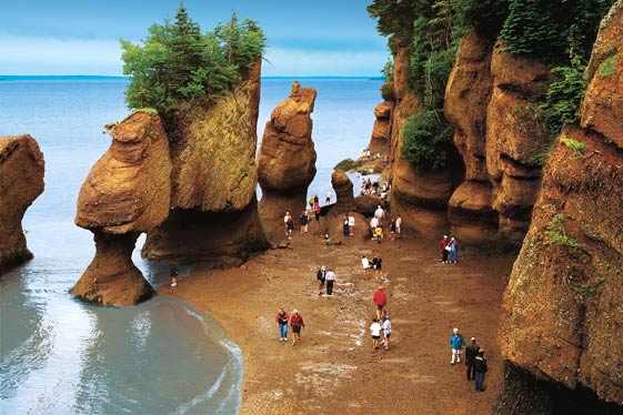
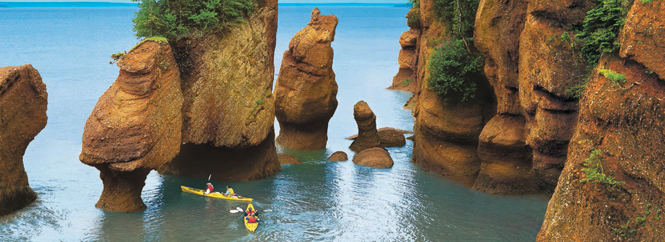
The Bay of Fundy at high and at low water
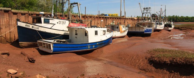
Port of Alma at the onset of the flood
The Bay of Fundy (English also Fundy Bay, Baie de Fundy French ) is located between the Canadian provinces of Nova Scotia and New Brunswick in the Gulf of Maine with a length of 220 km and a width of 60 kilometers. It is characterized by its exceptionally high tidal range of up to 21 meters. Your name derives from the Portuguese name Rio Fondo ( " Deep River ").
The first European description of the bay is from the year 1604 by the French explorer Pierre Dugua de Monts and his cartographer Samuel de Champlain as Baie François.
Largest ports in the bay are Saint John, which supplies a paper mill and a refinery, among other things, Hantsport with another paper mill as well as gypsum - exporting port and Digby.
Tides
In the western part of the Bay of Fundy, the Passamaquoddy Bay, which lies between the U.S. state of Maine and the Canadian province of New Brunswick is located. In the east, the bay has two arms, the Chignecto Bay and the Minas Channel ( Minas Channel) with the subsequent Minas Basin ( Minas Basin ).
In these poor flood runs on particularly high, reaching 16 meters tidal range at normal high water and up to 21 meter tidal range at spring tide, what are the highest Tidenunterschiede the world. This tidal range occurs due to a particularly strong resonance phenomenon here. The total length of the bay is about the distance that requires a water wave, in order to go through during a " Halbtide " ( about 6 hours). With everyone running into the bay tidal wave from the Atlantic Ocean in the Bay running back and forth tidal wave is amplified synchronously. A similar effect can be produced in a small space in a filled bath tub by a back and forth sloshing wave will be rocking to the beat.
The tidal range uses since 1984, the Annapolis tidal power plant to generate electricity with 18 MW capacity. Other tidal and marine current power plants are in the bay in planning.
An interesting phenomenon occurs in the tributaries of the Bay of Fundy at high tide, the flow direction is reversed with many of them. A few kilometers north of the Fundy National Park are the Hopewell Rocks, where the effect of the tides is to see rock formations.
In the eastern foothills, the Minas Basin, fall at low water nearly 40,000 hectares Watt dry.
Nature
She is also known for its stunning and rugged rock formations and forests on the rugged coast. A 20,700 hectares comprehensive of them was declared the Fundy National Park in 1948.
The marine life in the bay is very pronounced. The cool, nutrient-rich water in the bay makes for a rich population of krill, which attracts several species of cetaceans such as whales, humpback whales and Minke whales. The bird life is diverse, so come puffins, terns, before on the coast peregrine falcons and bald eagles. During the migration period here also gather large masses of sand beach runners.
For local fisheries have herring, American lobster, clams and salmon aquaculture importance.
Islands
- Grand Manan Iceland bordering the Gulf of Maine
In Passamaquoddy Bay:
- Campobello Iceland
- Moose Iceland
- Deer Iceland
Off Cape Chignecto:
- Isle skin
In the Minas Basin:
- Five Islands
In addition, there are smaller islands in the Passamaquoddy Bay, in the neighboring Back Bay and the Annapolis Basin.
Inflows
New Brunswick
- Saint Croix River
- Magaguadavic River
- Saint John River
- Petitcodiac River
- Tantramar River
In Nova Scotia
- Annapolis River
- Cornwallis River
- Avon River
- Shubenacadie River
- Salmon River


