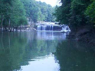
Cagles Mill Lake
The Cagles Mill Lake (also Cataract Lake ) is a reservoir on Mill Creek in Indiana and is used primarily for flood protection. The 1948 - 1952 erected by the United States Army Corps of Engineers earth and stone dam is located on the lower reaches of the river in Putnam County, about four and a half kilometers from the confluence of the Mill Creeks with the Big Walnut Creek. The larger the southeast part of the lake belongs to Owen County.
The lake is at normal storage - the lake level is at 193.9 m above sea level in winter and 194.3 m in the summer - an area of 5.7 km ². At high tide, the water level can rise by more than 20 meters, by the flooding of adjacent valleys, the lake then a more than three times bigger. An approximately 100 m wide constriction, called "Middle Narrows " divides the lake into two basins. A bridge crosses the Indiana State Road 42 across the narrow southern part of the lake. In the vicinity of the only island of the water body, Ernie Pyle Iceland lies.
Named the lake is an old mill just below the dam. This burned in 1975 from the weir is still preserved. The name is also used in Cataract Lake is derived from the Cataract Falls, located near the mouth of Mill Creek into the lake.
At the dam there is a state recreation area, the Lieber State Recreation Area.


.jpg)


