Lugrin
Lugrin is a commune in the French department of Haute- Savoie department in the Rhône-Alpes region.
Geography
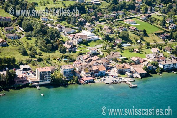
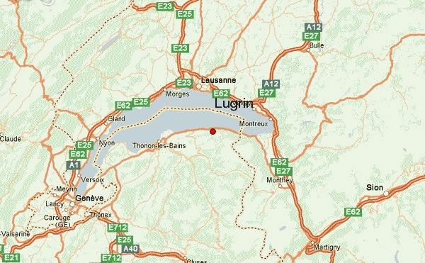
Lugrin is located on 413 m above sea level. Level, 15 kilometers east of the town of Thonon -les- Bains ( straight line ). The village is located in the Chablais, a scenic location on the lower north slope of the Savoy Alps, about 40 meters above the lake level of Lake Geneva.
The area of 13.22 square kilometers municipal area includes a section on the south bank of Lake Geneva; the lake shore line is about six kilometers. From the shores of the lake community area covers about the ever- rising slope up in the forest area of the Bois Rigoles, which is crossed by several gullies. Above this forest covers approximately 870 m above sea level. M. a natural terrace, the easternmost part of the Pays de Gavot. This leads to the forest height of Mont Bénand closes on which 1244 m above sea level. M. the highest elevation reached by Lugrin. East of the town of Lugrin enough floor to the rocky escarpment at Meillerie.
Community structure
To Lugrin addition to the actual village center includes several hamlets settlements:
- Allaman (410 m above sea level. M. )
- Vieille Église (440 m above sea level. M. )
- Tour Ronde (375 m above sea level. M. ) on the lakeshore
- Chez Busset (480 m above sea level. M. ) above the village
- Véron ( 483 m above sea level. M. )
- Troubois ( 455 m above sea level. M. )
- Les Combes ( 561 m above sea level. M. )
- Laprau ( 883 m above sea level. M. ) on the grounds terrace on the eastern edge of the Pays de Gavot, at the foot of Mont Bénand
Neighboring communities of Lugrin are Meillerie and Thollon -les- Mémises in the east, Bernex and Saint- Paul-en -Chablais in the south and Maxilly -sur -Léman in the West.
History
The territory of Lugrin was inhabited very early. There were traces from the Neolithic period, found from the Roman and Burgundian. First mentioned is the place in the 9th century under the name ad Logrino. Probably the place name of Celtic origin.
Attractions
The village church dates from the 19th century. The district of Tour Ronde was once a typical fishing village. In the vicinity of Lugrin there are several palaces, including the Château de Blonay ( 16th century, altered in the 19th century) near the lake, the Château d' Alleman and the Manoir des Chatillons.
Population
With 2303 inhabitants (as of 1 January 2011) Lugrin belongs to the medium-sized towns in the Haute-Savoie region. Especially during the 1980s, a strong growth of population was recorded thanks to the beautiful residential area. Outside of the old village created numerous houses.
Economy and infrastructure
Lugrin was until well into the 20th century a predominantly coined by farming village. Today there are various businesses of the local small business sector. Many working population commuters who engage in the larger towns in the area, especially in Evian- les- Bains and Thonon -les- Bains, their work.
The town lies somewhat above the main road N5, which runs from Thonon -les- Bains along the lake shore to Saint -Gingolph. Further road links exist with Maxilly -sur -Léman and Thollon.
The town had a station on the Tonkinlinie, a re- opening is planned by 2015.
Personalities
- Raymond Bouchex (1927-2010), Archbishop of Avignon


