Å tÃtnik
Geography
The municipality is located in the Slovak Karst, a part of the Slovak Ore Mountains Mountains, in the valley of the river of the same name. The village lies at the crossroads of various state roads, so there are connections to Rožňava (14 km east), Plešivec (14 km south ) and Jelšava (16 km west).
According to the 2001 census lived in the village of 1,523 inhabitants, of which 92 % Slovaks, 5% Roma, 1.6% Hungarians and 1% Czechs.
History
The village was first mentioned in 1243 as Chitnek, but was already inhabited in the 12th century, the community was founded by German miners. Thanks to its location, the mined ore and a hammer mill was the place in 1320 to market towns and eight years later he received the Karpfener city law. The Bebek family had at the beginning of the 15th century, a moated castle built in the town. The growth ended with the plague in 1555, and Turkish invasions in the 16th and 17th century, the German-speaking inhabitants were slowakisiert, the town records were kept until 1623 in German language. The patch was then once again ravaged by the plague in the years 1709-1710, yet the mining areas were maintained and decommissioned in 1955.
After place the Csetneker peak is named - a technique of Häkelspitzenanfertigung, which was invented in 1905 by resident siblings Szontagh.
Until 1918 the town belonged in the county Gemer and small Hont the Kingdom of Hungary and came afterwards to the newly formed Czechoslovakia.
The name is either the name of the squires ( Štítnik ) or the charcoal kilns ( vulgo sczyty ) have its origin.
Attractions
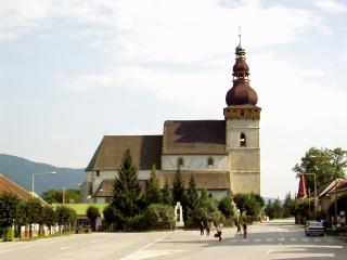
- Gothic Evangelical church from the 14th century (see picture)
- Baroque Roman Catholic Church from 1753
- Plague
- Baroque Curia
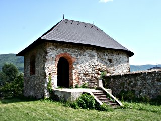
- Remains of Wasserburg ( see history)
- Emigration points in the Slovak Karst, eg Ochtinaer aragonite west of the community
Personalities
- Viktor Madarász (1830-1917), Hungarian painter
- Ctibor Štítnický (1922-2002), Slovak poet


