Attricourt
Attricourt is a commune in Haute -Saône in the Franche -Comté.
Geography
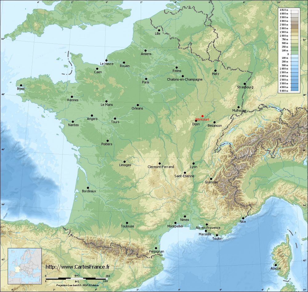
Attricourt situated at an altitude of 218 m above sea level, 16 km west of Gray and about 32 km northeast of the city of Dijon (air line). The village is located in the extreme west of the département, on the eastern edge of the valley of the Vingeanne.
The area of 6.08 km ² municipal area comprises a section in the rolling countryside of north west of Saônebeckens. The western boundary runs along the Vingeanne that flows through a Alluvialniederung south to the Saône. The flood plain is on average 215 m and has a width of about one kilometer. The river is accompanied by the waterway of the Canal de la Marne à la Saône, however, which runs on the western side of the valley outside the church banns.
From the river, the municipality's area extends eastward across the alluvial plain to the adjacent plateau, which reaches an average height of 240 m. The plateau consists of sediments of the Tertiary. It is divided by the valley of a page of Bach's Vingeanne in which the pond Etang de Thau Cossevosse and Charles are. While the western part of the plateau is used for agriculture, the eastern part is forest existed ( Bois des Envions, Le Puits Macheret and La Vaivre ). With 253 m is quite reach the east of the site of the highest point of Attricourt.
Neighboring communities of Attricourt are Saint-Seine- sur -Vingeanne in the north, Broye -les- Loups -et- Verfontaine in the east, Lœuilley and Dampierre- et- Flée in the south and Licey -sur -Vingeanne and Fontaine- Française in the West.
History
The territory was inhabited in prehistoric times. During excavations in 1840 swords and knives were found in stone sarcophagi. Further Excavations 1864, the foundations of a Roman building and five mosaics to light, and it may constitute the town founded by the Romans Ates.
Is Attricourt in 852 first mentioned. The place name derives from the Germanic personal name alterius and the old French word Cortem (Hof ) from. In the Middle Ages the village belonged to the Free County of Burgundy and in the territory of the Bailliage d' amont. The local government had held the Lords of Montigny. Together with the Franche -Comté reached the place with the Peace of Nijmegen in 1678 definitively to France. To a field change occurred in 1808, when Attricourt was incorporated into Lœuilley. Already in 1821 it received its independence as a municipality back. Since 2008 Attricourt is a member of the comprehensive 14 villages municipal association Communauté de communes des Quatre Vallées.
Population
With 35 inhabitants ( 1 January 2011) Attricourt one of the smallest municipalities in the department of Haute- Saône. After the population had decreased significantly in the first half of the 20th century (1886 125 people were still counted ), only small fluctuations were recorded since the early 1960s.
Economy and infrastructure
Attricourt is still a predominantly by agriculture (crops, orchards and livestock ), forestry and fish farming embossed village. Outside of the primary sector, there are few jobs in town. Some employed persons are therefore commuters who engage in the larger towns in the vicinity of their work.
The village is situated away from the larger passage axes on a secondary road, leading from Lœuilley to Saint -Seine- sur -Vingeanne. Another road connection with Licey -sur -Vingeanne.


