Bouvet Island
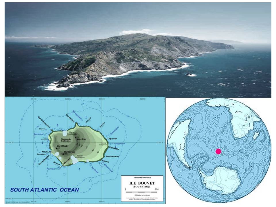
The Bouvet Island [ Buve - ] (Norwegian Bouvetoya ) is an uninhabited volcanic island in the South Atlantic Ocean, 2500 kilometers south west of South Africa's Cape of Good Hope. It is a dependent territory of Norway ( Biland ), but are not part of the Kingdom of Norway. The remote island is one of the hardest to reach and most isolated islands in the world.
Geography and climate
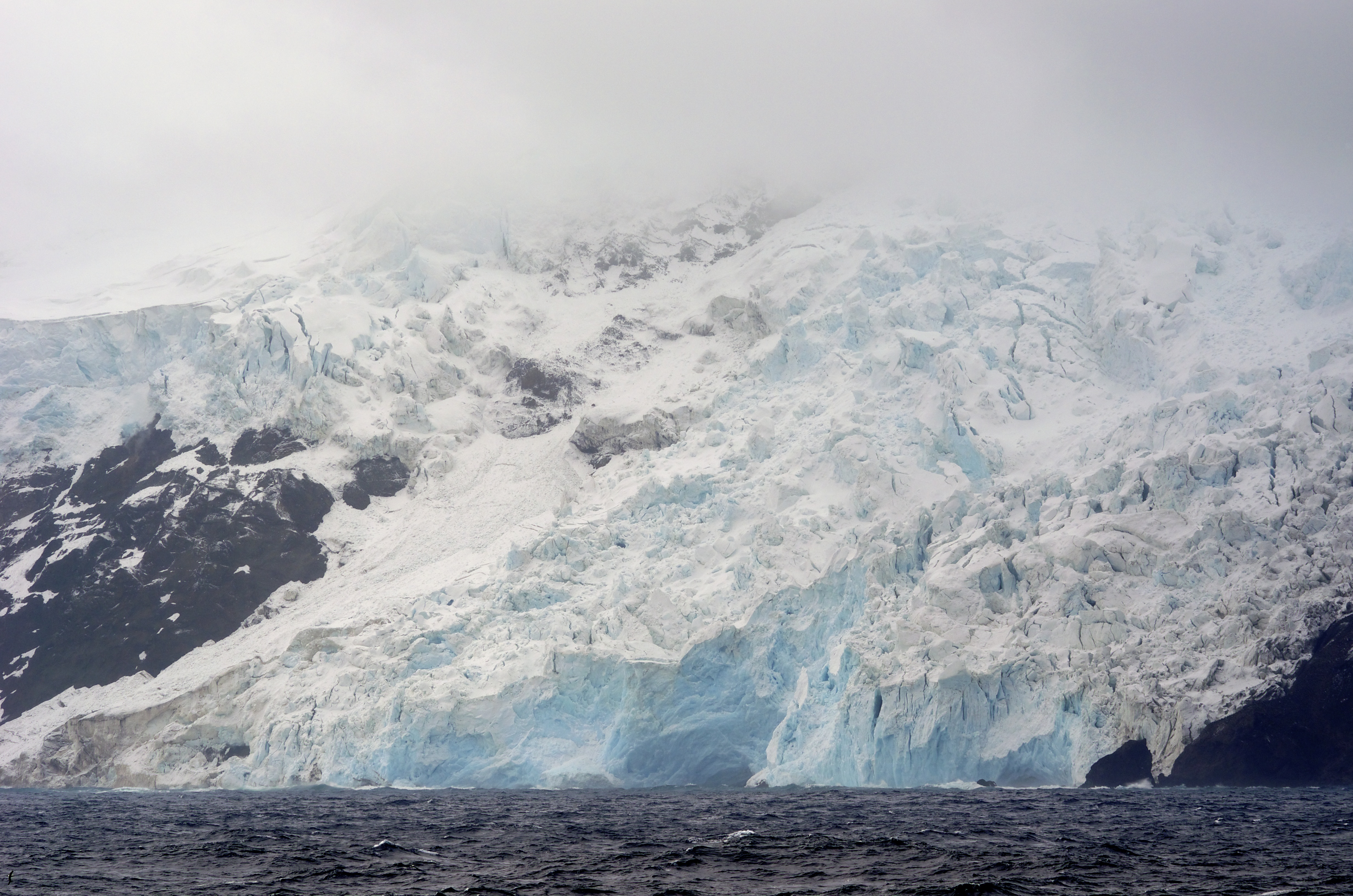
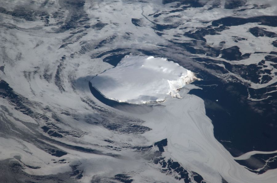
The 9 km long and up to 7.5 km wide island has an area of 49 square kilometers and is covered to 93% of glaciers. In the western part of the island is a volcanic crater, on the northeastern edge is the highest point with the 780 m high Olavtoppen. The crater opens to the north, where the Posadowsky glacier calves into the ocean. In the western part of the crater Inside there is the 700 meters wide and three kilometers long north-south direction Wilhelm II Plateau.
The Bouvet Island has no natural harbor. Nyrøysa ( New Sandefjord), is the only bay in which landings are possible is due to the ice-free west coast. This bay has an anchorage of about 20 m. Docking maneuvers are only possible when the prevailing wind. In the southwest of the island, the small island Larsøya is upstream.
The coastline of the Bouvet Island is ever changing. Especially the cliff coast in the West is losing by coastal erosion land to the sea. In contrast, the basalt rocks in the south of the island are relatively resistant.
The mean annual temperature is -0.6 ° C. Even in the summer, temperatures of more than 5.0 ° C is rarely achieved. The wind blows on average at a speed of 5 m / s
Geology
From a geological point of view, Bouvet Island is very young. It originated about 1.3 million years ago by volcanic activity in the Mid-Atlantic Ridge. The island is still volcanically active today. In the bottom of a temperature of 25 ° C was established in 1978 at a depth of 30 cm was measured.
Approximately 250 km west of Bouvet Island is the plattentektonisch certain triple point at which adjoin the African Plate, the South American Plate and the Antarctic Plate.
Flora and Fauna
Due to the harsh climate and the few ice-free areas only a sparse vegetation of lichens, mosses and fungi, of which about seventy species have been found there. Vascular plants are missing on the island.
The terrestrial fauna includes only four species of mites and three types of springtails. The marine mammals are represented by two species of seals, the Antarctic fur seals and southern elephant seals, and birds by penguins and seabirds. From twelve bird species is known to breed on the Bouvet Island. In addition to the reins, Macaroni and Adelie these are the silver Petrel, the Cape Petrel, the pigeons Petrel, the Wilson's Storm Petrel, the black belly - Sea Runner ( Fregetta tropica ), the Subantarktikskua, the Giant Petrel, Snow Petrel and the Antipodenseeschwalbe. The largest penguin colony is located on Nyrøysa, a 800 meter long and 400 meter wide gravel beach, which has only 1955-1958, probably formed by a massive landslide.
Among the regular summer visitors include the Royal Penguin, several species of Albatross, the Blue Petrel, various hooks shearwaters, the Feensturmvogel, the White-chinned Petrel ( Procellaria aequinoctialis ), the Great Shearwater, the Antarktikskua ( Catharacta maccormicki ) and Arctic Skua.
History
The Bouvet Island was discovered on 1 January 1739 by the French navigator Jean -Baptiste Charles Bouvet de Lozier, after whom it is named. However Bouvet could not land on the island and gave their geographical location inaccurately at (54 ° S, 4 ° 20 'E). Long was considered the sighted land, the Cape circoncision, a Northern Cape Terra Australis.
James Cook in 1772 found no land, but sailed south along and refuted on his journey the thesis of a Terra Australis. He suspected Bouvet might have seen an iceberg. Also in 1775 he did not find the island.
On October 6, 1808, the whaler James Lindsay and Thomas Hopper met with the ships Swan and Otter on the island and saw them as Lindsay Island at 54 ° 22 ' S, 4 ° 15 ' E, with a deviation of about 60 kilometers to the actual position. However, due to bad weather and pack ice around the island they could not land.
Benjamin Morrell from whalers Wasp succeeded in December 1822 as the first landing on the island. George Norris, the captain of the English whaling ship Sprightly, pinpointed in December 1825 even two islands, which he called Liverpool Iceland and Iceland Thompson. Later explorers such as James Clark Ross in 1843 with the HMS Erebus and Thomas Moore ( 1819-1872 ) in 1845 with the Bark Pagoda could not find any of the islands.
The Bouvet Island was rediscovered on 25 November 1898 by the German Valdivia expedition, which undertook a careful localization and the first mapping of the island. Even today, geographical names such as Cape Valdivia and Wilhelm plateau it. A thorough search of the Valdivia proved that there are no other islands in the larger radius. The 1926 was confirmed as the German research vessel Meteor a sea depth of 1579 m explored at the position specified for the Thompson Island.
First, the island was claimed by any state, to Captain Norris took on December 10, 1825 for the British king in possession. On August 31, 1927 occupied Harald Hornvedt, the captain of the research vessel Norvegia, the Bouvet Island for the Kingdom of Norway. After diplomatic negotiations, in which the Norwegian side took the view that the British rights were extinguished by failure to exercise, Britain renounced on 19 November 1928 on the assertion of its claims. Since 27 February 1930, the island ( Biland Apart from land, Norwegian ) is a dependent territory to Norway. The Bouvet not subject to the provisions of the 1961 Antarctic Treaty came into force, as it is located north of the 60th parallel.
1971, Bouvet Island and the surrounding waters were declared a nature reserve.
On September 22, 1979, came between Bouvet Island and Prince Edward Island to the so-called Vela Incident. An American Vela - monitoring satellite registered an explosion in which it may have been a common atmospheric nuclear test South Africa and Israel.
Efforts to build a research station remained long without success. A built by Norvegia Expedition 1928 depot hut had already disappeared in the following year. The South African Bouvet expedition of 1955 did not find a suitable place for a manned weather station. Only in 1977 took Norway automatic station in operation. December 24, 1978 to March 8, 1979, a Norwegian research team held on to the island and led by biological and geological research. The brought it to the island huts were soon lost. 1996 enshrined the Norwegians a 36 m² living containers as temporary research station on the island. On 19 October 2007, the Norwegian Polar Institute (NPI ) announced that the station would no longer be seen on current satellite images. Scientists at the NPI set in December 2007 laid during a visit that the entire station area was overthrown in a landslide into the sea.
Others
For the Bouvetinsel the country code top -level domain ( ccTLD). Bv, but which is currently unused exists. It is managed by the company UNINETT Norid AS, which is also responsible for the Norwegian ccTLD. No. Just as the ccTLD of Svalbard and Jan Mayen (. Sj ) the top level domain of the Bouvet Island for potential future use is reserved. In 1990 the island was visited by an international amateur radio expedition and from there the call 3Y5X enabled.


