Barraba, New South Wales
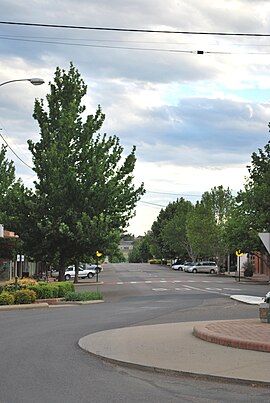
Barraba is a town in the northeast of the Australian state of New South Wales. The city in New England was the center of the former Barraba Shire Local Government Area, which is but risen in 2004 for the most part in the Tamworth Regional Council. At the 2006 census Barraba had 1,161 inhabitants.
- 3.1 striking, weather extremes
History
The Kamilaroi, a Aboriginesstamm, lived in the area of today's Barraba before the arrival of the Europeans. The first white man in the area was the botanist Allan Cunningham in 1827. He also discovered the Manilla River, which he named Buddle 's Creek. A sheep station called Barraba Station was built in 1837 or 1838. In July 1852, the surveyor assistant JT Gorman surveyed the area of the present town.
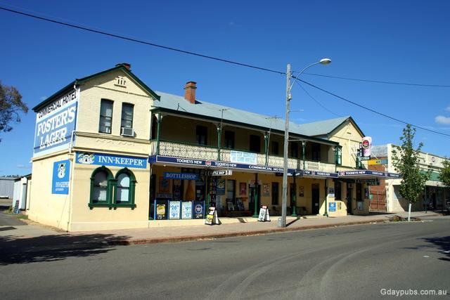
In the 1850s the gold rush in the area led to the growth of a settlement. On April 1, 1856 the first post office was opened in Barraba, 1882 was the first post office in brick construction. There was a school that was opened in a rented building in 1861. In September 1876 Crown land was auctioned in Barraba. In the same year the first church of St. Laurence, and the first bank buildings were constructed. 1878 Commercial Hotel was built and three years later they built the courthouse. On March 20, 1885 Barraba became a town. Many other important buildings were constructed in the 1890s in the city, such as the hospital (1891 ) and the Weslyan Church ( 1898). Barraba 1893 reached a population of 500; to 1921, it rose to 1,164.
The first local newspaper, the Barraba Gazette came in 1900 for the first time out. The last section of Barraba Railway Line from Manilla was opened on September 21, 1908 without special celebrations. The last train to Barraba drove on 21 September 1983, most of the railway line was closed on 25 November 1987. In 1933 they built the Connors Creek Dam as a storage for water supply of the city.
Mining
Copper
1889 copper was discovered in Gulf Creek near Barraba and 1892 there the first mine was put into operation. After the commencement of mining a village with hotel, school and post office was established. The post office in Gulf Creek was opened on August 1, 1897 and closed on February 28, 1966 its doors again. At the best of times this was one of the largest copper mine in New South Wales. In July of the same year, the population of the village had increased to 300.
Asbestos in Woodsreef and the consequences
Asbestos was first in 1919 in Woodsreef, on a 400 -acre site, also at Barraba degraded. The Chrysotile Corporation of Australia led from 1970 to 1983 the reduction in grand style by. The mine yielded about 500,000 tons of chrysotile (white asbestos ) at 100 million tons of overburden.
After the end of mining activities a waste dump of 75 million tonnes remained, which covered an area of about 117 ha. In addition, a Tailinghalde of 25 million tonnes was developed, which covered about 43 hectares. The Tailinghalde has an average height of 45 m. Its highest point is at 70 m height.
On 13 August 2008 a report on the television program The 7:30 Report described the growing concern that the tailings of the abandoned open pit could pose a health risk to local residents and the passing tourists. The urgent Asbestos Disease Foundation of Australia called for a cleaning of the premises and a barring order for the public, although still a public dirt road leads through the dangerous terrain.
The report in The 7:30 Report led to a hastily study conducted by Hunter New England Health on the consequences for the health of community residents Barraba .. Despite the efforts of the Northern Daily Leader and the ABC, the results publicized to some, the investigation was Although completed, but not published
According to a report of the Ombudsman for New South Wales in November 2010, the quarry site in Woodsreef is the only former asbestos mining site in the state, which has not yet been rehabilitated.
Climate and Weather
The weather station at the post office Barraba was first opened in March 1881 as rainfall measuring station. In March 1966, it was expanded into a full-fledged weather station, in which a meteorological observer performed the readings.
Striking, weather extremes
Over the years there have been a number of notable weather phenomena, such as:
Transport and Tourism
The tourist route Fossickers Way ( State Road 95) leads on their way from Tamworth to Warialda by Barraba. The city was also the terminus of the former railway line from Tamworth ago.
Barraba is the Bundarra - Barraba Important Bird Area, IBA, in particular the endangered Regent Honeyeater ( Anthochaera phrygia ) is protected.
Water supply
The city gets its drinking water normally from the Manilla River, the Barraba Creek and Connors Creek Dam. If these sources dry up, must be drilled to groundwater.
The Split Rock Reservoir was built in 1988 and has a connection Rohe in his dam, to which a pipe can be connected by Barrraba. The pipeline itself but was never built. End of 2007, wrote the then responsible for water supply Minister Phil Koperberg at the Tamworth Regional Council, that he instead reflect on an AU $ 10 million expensive water pipe.
2011 was expected already at a cost of AU $ 20 million for the construction of a pipeline from Split Rock Dam after Barraba. The Tamworth Regional Council has pledged AU $ 10 million and is trying to move the State and the Commonwealth of Australia to commitments over the remaining sum.


