Betaucourt
Betaucourt is a commune in Haute -Saône in the Franche -Comté.
Geography
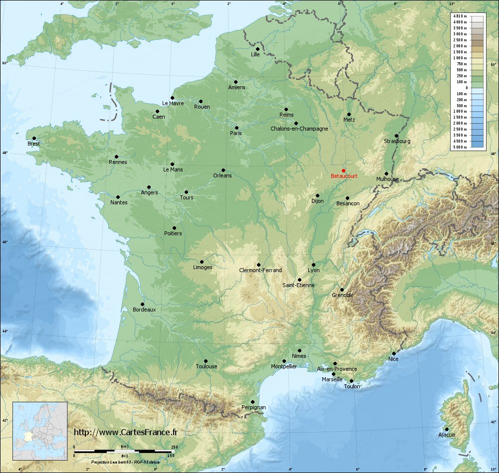
Betaucourt situated at an altitude of 220 m above sea level, 4 km north of Jussey and about 32 km northwest of the town of Vesoul (air line). The village is located in the extreme north- west of the department, on the western edge of the broad Talniederung the Saône, at the southeastern edge of the height of the Donnet.
The area of 7.17 km ² municipal area includes a portion in the region of the upper Saônetals. The eastern boundary runs mostly along the Saône, which here flows through a 1.5 -kilometer-wide Alluvialniederung south. The flood plain is on average 215 m and is used mainly for agricultural purposes. The river is channeled and developed for Waterway; section of Betaucourt there are two lock works. Remnants of the old barrel with several small loops are present.
From the river, the municipality's area extends westward across the flood plain to the adjacent, slightly undulating landscape. To the north, the terrain rises to the wooded ridge of Donnet. On the southern slope of the highest peak of Betaucourt is achieved with 283 m. In geological- tectonic terms, the terrain consists of an alternation of sandy- marly and calcareous sediments that were deposited on the merits during the Lias ( Lower Jurassic ).
Neighboring communities of Betaucourt are Villars -le- Pautel in the north, Aisey -et- Richecourt and Ormoy in the east, and Cendrecourt Jussey in the south and Rain Court in the West.
History
In the Middle Ages Betaucourt belonged to the Free County of Burgundy and in the territory of the Bailliage d' amont. It formed a fief, which was dependent on the rule Bourbévelle. In the 13th century the rule was transferred to the monastery Cherlieu. Together with the Franche -Comté Betaucourt came with the Peace of Nijmegen in 1678 definitively to France. In 1750, here is a blast furnace was established, which was until the end of the 19th century in operation. Today Betaucourt is a member of the 17 localities comprehensive community association Communauté de communes du Pays Jusséen.
Attractions
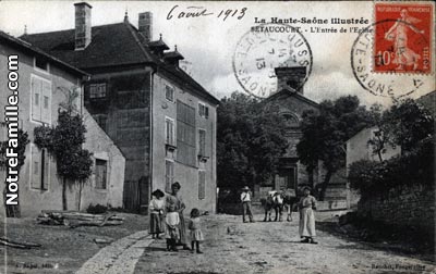
The village church of Betaucourt was rebuilt in the 19th century. In-room amenities include a richly carved wooden pulpit (17th century), altars and statues from the 18th century and several grave slabs. On an open field north of the town is the chapel of Saint- Brice. Additional points of interest include three Lavoirs and the ruins of the medieval castle Betaucourt.
Population
With 161 inhabitants ( 1 January 2011) Betaucourt one of the small towns in the Haute- Saône. Throughout the 20th century, the population decreased continuously (1886 were still 422 persons counted ).
Economy and infrastructure
Was Betaucourt until well into the 20th century a predominantly by agriculture ( farming, viticulture and animal husbandry ) and forestry embossed village. Today, there are some establishments of local small businesses. In recent decades the village has been transformed into a residential community. Many workers are therefore commuters who engage in the larger towns in the vicinity of their work.
The village is situated away from the larger passage axes on a secondary road, leading from Jussey by Corre. Further road links exist with Cendrecourt and Rain Court.
Aisey -et- Richecourt | Barges | La Basse -Vaivre | Betaucourt | Blondefontaine | Bourbévelle | Bousseraucourt | Cemboing | Cendrecourt | Corre | Demangevelle | Jonvelle | Jussey | Magny- lès- Jussey | Montcourt | Ormoy | Passavant- la- Rochere | Rain Court | Ranzevelle | Tartécourt | Villars -le- Pautel | Vougécourt
- Commune in the department of Haute- Saône
- Place in Franche -Comté


