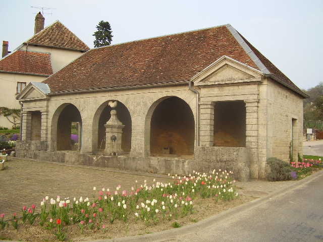
Chaux-la-Lotière
Chaux -la- Lotière is a commune in Haute -Saône in the Franche -Comté.
Geography
Chaux -la- Lotière situated at an altitude of 250 m above sea level, 8 km west-southwest of Rioz and about 16 km north of the city of Besançon (air line). The village is located in the south of the department, to the north of the Valley of the Ognon in the valley of the Ruisseau de l' Etang du Vau at the southern foot of the heights of the Bois du Chanois.
The area of 8.88 km ² municipal area includes a portion of the undulating landscape between the river valleys of the south and Ognon Saône in the northwest. The central part of the area is crossed from north to south from the little valley of the Ruisseau de l' Etang du Vau, which provides for drainage to Ognon. On both sides of this valley to a plateau spreads, the average is 260 m and is inclined slightly to the south. It consists of deposits from the Tertiary. The area is mainly consisted of arable and meadow land. To the north, the municipality's area extends in the hilly area of the Bois du Chanois (up to 330 m) and on the crest of Rochefort. Here the highest elevation of Chaux -la- Lotière is achieved with 338 m.
To Chaux -la- Lotière includes two hamlets settlements:
- La Lotière (225 m) in the valley of the Ruisseau de l' Etang du Vau
- Rochefort (280 m) on the plateau west of the Ruisseau de l' Etang du Vau
Neighboring communities of Chaux -la- Lotière are cordonnet and Montarlot -lès- Rioz in the north, the east and Boult Boulot in the south.
History
The traces of a location on the Châtelard point to an early settlement of the area. In the Middle Ages Chaux -la- Lotière belonged to the Free County of Burgundy and in the territory of the Bailliage d' amont. The local government of the village held the Lords of Boult. Together with the Franche -Comté came Chaux -la- Lotière with the Peace of Nijmegen in 1678 definitively to France. Today the village is a member of the comprehensive 28 villages municipal association Communauté de communes du Pays Riolais.
Attractions
In the hamlet Rochefort is a former seat of power.
Population
With 382 inhabitants ( 1 January 2011) Chaux -la- Lotière one of the small towns in the Haute- Saône. After the population had decreased significantly in the first half of the 20th century (1886 249 persons were still counted ), a strong population growth has been recorded since the mid-1970s again. Since then, the population has nearly tripled.
Economy and infrastructure
Chaux -la- Lotière was until well into the 20th century a predominantly by agriculture (crops, orchards and livestock ) and forestry embossed village. The most important employer is now the Blechfabrik Plimétal. There are also some plants of the local small business sector. In recent decades the village has been transformed into a residential community. Many workers are therefore commuters who do their work in the larger towns in the area and agglomeration in Besançon.
The village is situated away from the larger passage axes on a secondary road that leads from Boult to Bonn event. The nearest links to the A36 motorway is located at a distance of about 15 km. Further road links exist with Boulot and cordonnet.
Aulx -lès- Cromary | Boulot | Boult | Bussières | Buthiers | Chambornay -lès- Bellevaux | Chaux -la- Lotière | Cirey | cordonnet | Cromary | Fondremand | Hyet | Maizières | La Malachère | Montarlot -lès- Rioz | Neuvelle -lès - Cromary | Pennesières | Perrouse | Quenoche | Recologne -lès- Rioz | Rioz | Sorans -lès -Breurey | Traitiéfontaine | Trésilley | Vandelans | Villers -Bouton | Voray -sur- l'Ognon
- Commune in the department of Haute- Saône
- Place in Franche -Comté


