Kerr Lake
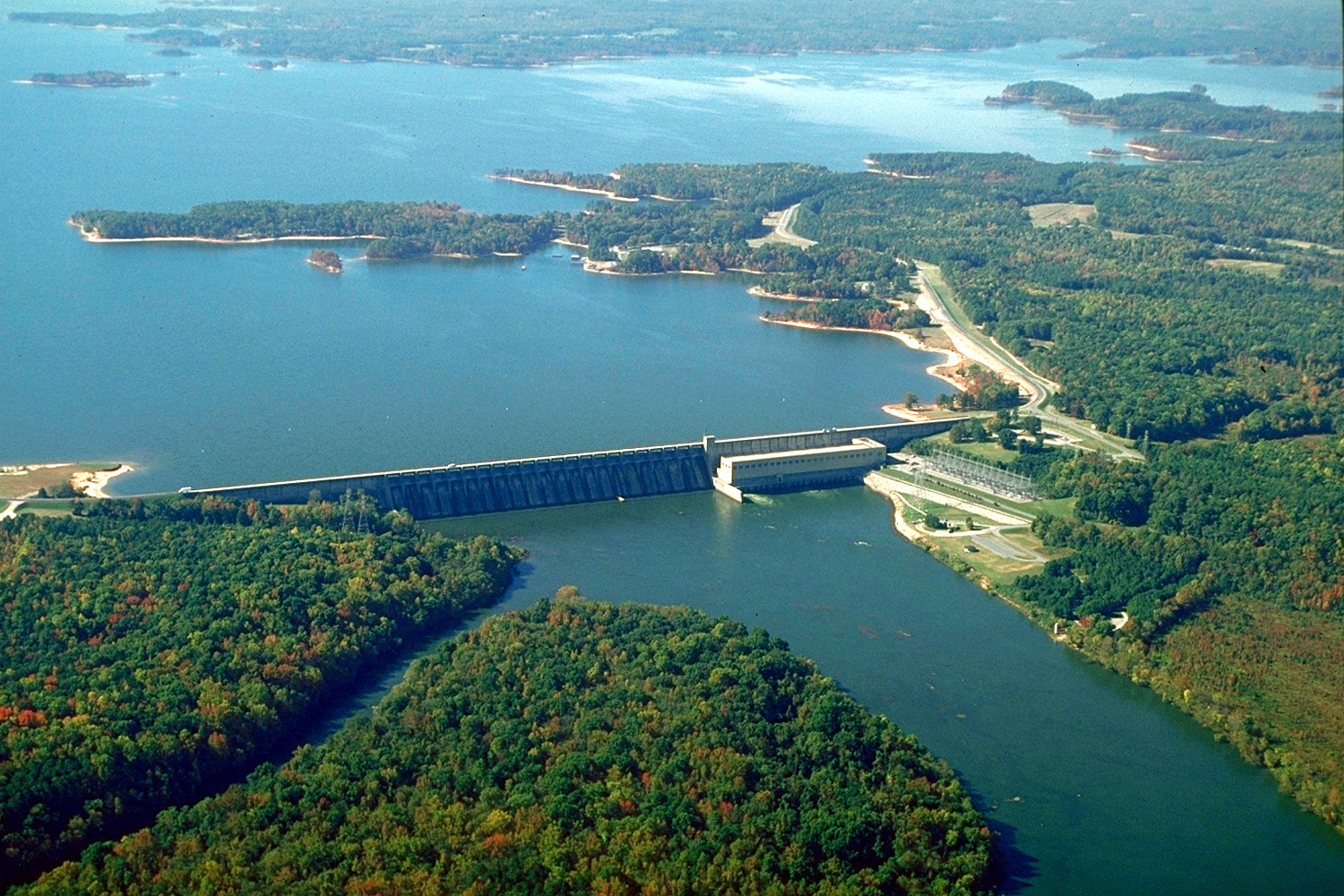
The John H. Kerr Reservoir (or in German spelling: John H. Kerr Reservoir in short, Kerr Lake, Buggs also Iceland Lake ) is a reservoir in the southeastern United States. It is located at the middle Roanoke River in the U.S. states of Virginia and North Carolina. At normal water level (91 m above sea level. M. ) the lake has an area of 198 square kilometers.
Was named the reservoir after Congressman John H. Kerr from North Carolina; in Virginia, however, is widely also the original project name " Buggs Iceland Lake " in use. Built and operated the Kerr Reservoir from the United States Army Corps of Engineers.
Location
The dam of the reservoir is above Buggs Iceland in Mecklenburg County. In this county there is also a large part of the reservoir, in the south it extends to near the city of Henderson. A total of six counties have a more or less large share of the reservoir. In Virginia, these are in addition to the Charlotte Mecklenburg and Halifax County, North Carolina, the counties of Granville, Vance and Warren.
The reservoir is fed mainly from Roanoke and Dan River. This led once at Clarksville ( Virginia) in the Roanoke River after both rivers flowed around twelve kilometers, parallel through a valley. Their course follows still a Countygrenze. This one kilometer long but only a few hundred meters wide strip of northwestern John H. Kerr reservoir is one of Halifax County, while the lakeside remained with the Mecklenburg County. To the south is the flooded part of the Nutbush Creek a large - for Vance County belonging - bay.
John H. Kerr Dam
The construction work for the shut-off began in March 1947 and lasted until early 1953. As a location for the dam in the hard granite surface has been chosen to be close Buggs Iceland. The John H. Kerr Dam consists of a concrete gravity dam, which is flanked by lower earth dams on both sides. Overall, the dam has a length of 6716 m, of which the central concrete wall 876 m. This is up to 44 meters high and contains 22 flood gates. Below the dam is the power house of the plant.
A small auxiliary dam 15 km to the southwest prevents the flooding of Iceland Creek Valley. The water from the Iceland Creek Reservoir created there has to be pumped up in the Kerr Lake.
Use
The two main functions of the John H. Kerr reservoir are flood control and power generation. In addition, the large artificial lake with approximately 1,300 km long bank is a regional tourist destination.
The normal water level is 91.4 m above sea level, the storage space is then 1.8 billion m³. As a flood control room further 6.1 m dam height are scheduled. In extreme cases, the dam can store more water m³ 2.3 billion. The reservoir covered at a level of 97.5 m above sea level. M. instead of the normal 198 km ² 337 km ² then. The highest water level was on 29 April 1987, 97.4 m above sea level. M. reached.
For power generation, seven main and two auxiliary turbines are located in the power house directly below the dam. These have a combined maximum output of 206 MW and produce on average 407 million kWh of electricity per year. The usable quantity of water from 81.7 to 91.4 m above sea level is 1.27 billion cubic meters. Just below the Kerr Dam starts the storage of Lake Gaston.
The largest lake in Virginia is also a popular destination for tourists. Almost the entire river is open to anglers and boaters. On the banks there are several parks for visitors, including the State Park Staunton River and Occoneechee in Virginia and Kerr Lake State Recreation Area in North Carolina.


