Muriaux
Muriaux is a municipality in the district Franches- Montagnes in the canton of Jura in Switzerland. The former German name Spiegelberg is no longer used today.
Geography
Muriaux is located on 947 m above sea level. M., 2 km southwest of the district municipal seat Saignelégier (air line). The village is located in a depression on the Jura plateau of the mountains free (French Franches- Montagnes ), east of the deep valley of the Doubs.
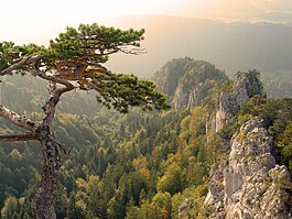
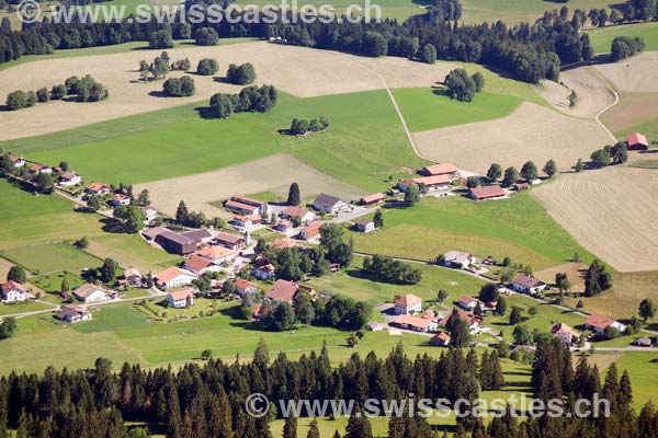
The 14.3 km ² municipal area covers a portion of the gently undulating plateau of the Jura plateau, on the alternate boggy, usually above ground endorheic valleys with peaks of limestone. North of Muriaux the height Derrière le Cras is ( 995 m above sea level. M. ), south of the village the elevation of Craloup ( 1,108 m above sea level. M. ). These heights fall steeply to the west from Doubs Valley, the upper side of the valley still belongs to the municipality of Muriaux. The border runs along the Felsgrates Arête of Sommêtres on which the ruin stands Spiegelberg. But by far the largest part of the municipality take extensive pastures of the Jura with a standing individually or in groups large spruce and intervening forest areas. In the south Muriaux extends to the height ( 1,115 m above sea level. M. ) north of Les Breuleux.
An area located south of the main enclave comprises the area in Cerneux- Veusil in the broad valley between the Jura chain of Point de Vue in the north and the Montagne du Droit in the south. It is increased since January 1, 2009 through the former municipality of Le Peuchapatte.
On the northern slope of Mont Soleil, part of the Montagne du Droit, was until its merger with Le Peuchapatte with 1'120 m above sea level. M. the highest point of Muriaux. From the municipality surface 1997 4 % came from settlements, 38 % of forest and woody plants and 58 % to agriculture.
To Muriaux include the hamlet of Les Emibois ( 955 m above sea level. M. ) Les Ecarres (970 m above sea level. M. ) Les Chenevières (980 m above sea level. M. ) Le Roselet ( 1'052 m above sea level. M. ) and Cerneux- Veusil ( 1'035 m above sea level. M. ), all located on the plateau of the mountains free, and remote farms on the mountain pastures of numerous farmsteads.
Neighboring communities of Muriaux are Manderscheid, Saignelégier, La Chaux -des- Breuleux, Les Breuleux and in the Canton of Jura and Villeret and Saint- Imier in the Canton of Bern.
Population
With 475 inhabitants ( 31 December 2012) Muriaux one of the smaller municipalities in the canton of Jura. Of the 91.2 % inhabitants are French-speaking, German-speaking 7.4 % and 0.5 % Italian-speaking (as of 2000). The population of Muriaux peaked already in 1860. Thereafter, a decline of about 60 % to 1970 was due to strong emigration records. Since then, a slightly increasing trend is observed again.
Economy
Muriaux is still strong dominantly agricultural village with dairy farming and cattle breeding. Outside the primary sector there are relatively few jobs. Many workers are therefore commuters and work in the neighboring towns Saignelégier or Manderscheid. In the hamlet Le Roselet is the foundation for the horse.
Traffic
The community is conveniently comparatively quite well developed. It is located approximately 600 m west of the main road from Delémont to La Chaux -de-Fonds. On December 7, 1892, the railway line of the Chemins de fer du Jura from La Chaux -de-Fonds to Saignelégier was opened with one station at Muriaux and Les Emibois.
History
The first mention of the local noble family Mireval dated to the year 1315. Surnames forms of Muriaux are Mervaux, Murival and Murval. Origin of the settlement area of the castle is Muriaux Spiegelberg, which was probably built in the 13th century. This castle was from the 14th to the 17th century residence of the bailiff of the reign free mountains covered by the prince-bishops of Basel. The village Muriaux developed in 1300 in the vicinity of the castle. Between 1793 and 1815 Muriaux belonged to France and was initially part of the département du Mont- Terrible, associated from 1800 with the Department of Haut -Rhin. By the decision of the Congress of Vienna, the place came in 1815 to the canton of Bern and on 1 January 1979 at the newly founded Canton Jura. Since Muriaux does not have its own church, it is connected to the parish Saignelégier.
Attractions
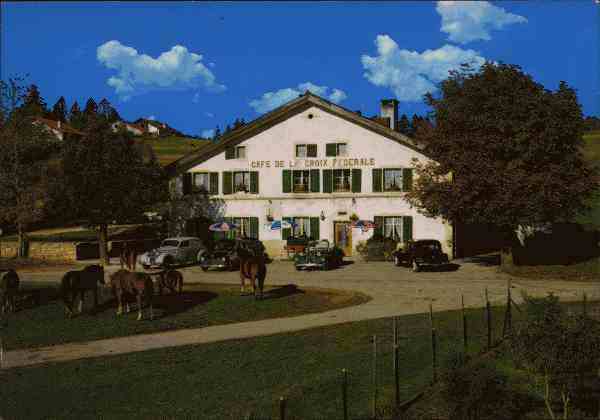
On the prominent rocky ridge Les Sommêtres is ruined Spiegelberg, where today a small tourist hostel is, by offering a breathtaking view into the canyon-like cut in the Plateau Jura valley of the Doubs. In the various hamlets typical farmhouses of the 18th and 19th centuries have been preserved with whitewashed facades and large roofs. Muriaux was until 2008 Location of a car museum ..


