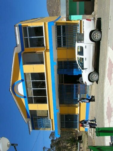
Cairoma Municipality
The municipality Cairoma is a district in the department of La Paz in the South American Andes State of Bolivia.
Location in near space
The municipality Cairoma is one of five Municipalities of the province Loayza and is located in the northeastern part of the province. It is bordered on the northwest by the province Murillo, on the west by the municipality of Sapahaqui, on the southwest by the municipality of Luribay, on the southeast by the municipality of Malla, on the east by the province Inquisivi, and to the north by the province of Sud Yungas.
The municipality has 67 localities ( Localidades ) Central place of the municipality is Cairoma with 976 inhabitants in the south-eastern part of the county, the biggest town in the municipality of Viloco with 1,403 inhabitants. ( 2001 census )
Geography
The municipality Cairoma is on an average height of 4000 m in the Cordillera Serranía de Sicasica, between the Bolivian Altiplano in the west and the Amazon lowlands to the east. The climate of the region is a typical diurnal climate where the temperature variations during the day be stronger than during the year.
The mean average temperature of the region is located at 9 ° C, the monthly values vary between about 5 ° C in June / July and 11 ° C in November / December. The annual rainfall is just 550 mm, with a pronounced dry season from May to August, monthly values below 15 mm, and a humidity season from December to February values 90-125 mm.
Population
The population of the municipality Cairoma has increased by about a third in the past two decades:
The municipality had at the last census of 2001, a population density of 21.1 inhabitants / km ², the life expectancy of newborns was 54.7 years, the infant mortality rate was 5.8 per cent ( 1992) rose to 9.5 percent in 2001.
The literacy rate for those over 19 years is 79.2 percent, and 88.9 percent, although in men and 69.0 percent for women ( 2001).
82.3 percent of the population speak Spanish, 87.7 percent speak Aymara, Quechua and 4.2 percent. (2001)
60.2 percent of the population have no access to electricity, 97.3 percent have no sanitary facilities ( 2001).
89.4 percent of the total 2,342 households own at least one radio, 36.6 percent have a television, 15.6 percent a bicycle, a motorcycle 1.0 percent, 2.7 percent, a car, a refrigerator, and 0.8 percent 0, 8 percent a telephone. (2001)
Policy
Structure
The municipality is divided into the following five cantons ( cantones ):
- Cantón Asiento Araca - 4,604 inhabitants ( 2001)
- Cantón Cairoma - 2,494 inhabitants
- Cantón Keraya - 3,457 inhabitants
- Cantón Saya - 548 inhabitants
- Cantón Tienda Pata - 235 inhabitants


