Chartreuse Mountains
F1
Outline of the French Western Alps
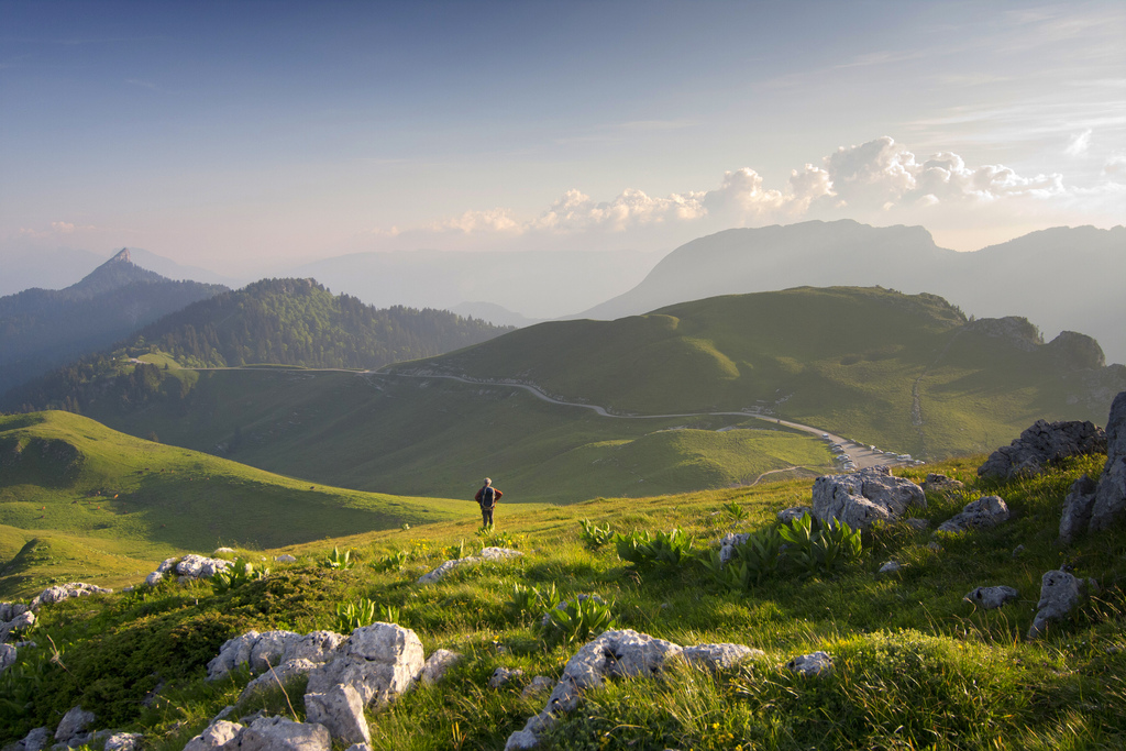
The Chartreuse is a semi-highland massif of limestone in the northern French Alps. The massif, whose highest peak is the Chamechaude with a height of 2082 m, is located in the departments of Savoie and Isère. It is allocated geographically to Chaînes subalpine Septentrionales (northern Alps) and geologically the French Alps. The very sparsely populated mountain area is a nature reserve (Regional Natural Park Chartreuse ).
In a remote side valley of the Guiers - Mort Bruno founded in Cologne in 1084, the monastery Grande Chartreuse. It is the mother monastery of the Carthusian Order.
- 3.1 Tourism
- 3.2 Nature Park
Geography
Location
The Chartreuse is located in southeastern France in the Rhône-Alpes region, between the cities of Grenoble and Chambery. In the north and north-east separates the Talfurche of Chambéry - a slightly curved longitudinal valley - the massif from that of the Wallows. To the east and southeast of the Chartreuse is delimited by the broad valley of the Isère, which is referred to in this section Grésivaudan, from the high alpine chain of Belle Donne, which already consists of crystalline rocks. The Isère describes in Grenoble on the southern edge of the massif a sharp bow and then flows into a transverse valley, the cluse de l' Isère, to the northwest. This water gap separates the Chartreuse massif from the south-west following the Vercors. Only a narrow Talfurche limits the Chartreuse in the west and leads directly to the anticlines of Ratz and Epine, which form the southern chain of the Jura Mountains. Only west of this ridge connects to the Molasse Basin of the Rhone trench.
Surface shape
The mountain complex, the chartreuse an area of approximately 40 km in south-southwest - north- northeast direction with a width of around 15 km. The relief is characterized by a series of mountain chains which also show this orientation direction. In between are some narrow longitudinal valleys, the longitudinal recess of Saint -Pierre- de -Chartreuse and Saint- Pierre- d'Entremont and two narrow, deep transverse valleys. The mountains of the Chartreuse characterized by distinctive, usually sloping downwards, up to 200 m high and often steep Asked cliffs of limestone. Such cliffs are to follow in some places practically without interruption over a distance of up to 10 km in the landscape. Stretches along the eastern flank of the massif to an average of 1000 m the Plateau des Petites Roches, a terrain terrace with several villages, located about 700 m above the valley floor Grésivaudan.
Mountain peaks and rivers
Among the major peaks (in order of height):
- Chamechaude, 2082 m, in the south of the massif
- Dent de Crolles, 2062 m, in the eastern
- Lances de Malissard, 2045 m, in the eastern
- Grand Som, 2026 m, in the center
- Mont Granier, 1933 m, prominent mountain in the northeast of floor
- Sure Grande, 1920 m, in the West
- Charmant Som, 1867 m, in the center
- Pinea, 1773 m, in the south
- Mont Outheran, 1676 m, in the north
The two rivers Guiers Vif and Guiers - Mort drain a large part of the Chartreuse massif. Both originate in karst springs on the western slope of the eastern mountain range and then flow westward, where they first cross the longitudinal trough. Then they break through the western mountain ranges of the massif, before they flow together in the wild canyons in the Talniederung in Entre -deux- Guiers. The Guiers now called river bends to the north and eventually empties into the Rhone. The southernmost section of the Chartreuse massif lies in the catchment area of the Isère as well as the eastern flank of the mountain. Here are some short streams have created various gullies.
Geology
In geological terms, the structure Chartreuse is a fold mountain at the edge of the Western Alps. It consists of a powerful layer of Mesozoic sediments that were deposited in the ocean of Tethys. The layer sequence extends from the lower Jurassic period ( Lias, before about 200 million years ago ) to the Late Cretaceous ( 65 million years ). During this long period of time numerous clayey, marly limestone layers and layers were sedimented. While the latter point more to conditions in a warm shallow sea, the marly layers mainly from periods with cooler water and at least partially originate deep marine conditions ( sediments were deposited in the deep sea). The thickness of the sedimentary layers shows significant regional variations within the Chartreuse massif. For example, taking the thickness of the strata from the Lower Cretaceous in a profile from west to east by more than 100 %.
About the sediments of the Mesozoic lay down in the early Tertiary further sands, marls and limestones. In the course of the Tertiary these sedimentary layers were raised in the formation of the Alps above sea level and connected to form a fold mountain. From this time began the erosion ( by water, wind and ice) and transported over the detritus in the foothills of the Alps. The Lower Tertiary sediments were therefore largely eroded. On the western edge of the Chartreuse massif, a marine basin had opened in the Miocene, which was filled up with the times by the erosion of material from the rising mountain ranges.
The various uplift and reduction processes led to the formation of numerous faults, fault lines and thrust faults. During the ice ages the glaciers contributed to a significant mass in the modeling of the relief and Aushobelung the broad valley furrows, which limit the Chartreuse. The Chartreuse itself remained largely ice-free except for a few cirque glaciers.
As a result of the strong interaction and the thrust faults, most of which are oriented towards the west southwest -northeast, the typical anticlinal and Synklinalstrukturen basis of the relief can not be so easily seen in the adjacent bauges. The western part of the Chartreuse is characterized by three to four successive thrusts of the sedimentary complex of the Upper Jurassic to Upper Cretaceous. Therefore, the layers fall against the south-east and east. In contrast, the eastern part of the mountain is somewhat less strongly folded, but also disturbed by broken lines.
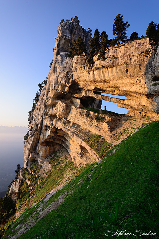
Summit development it the mighty rock layer is the Urgonkalke ( deposited in the Cretaceous period about 110 million years ago) in almost the entire massif. It is characterized by steep, vertical sloping rock walls. From this banked limestone layer which is partly more, partly eroded less, among others, the Summit Chamechaude, Dent de Crolles, Grand Som and Mont Granier are built. The slightly older layer of Fontanil limestones ( Lower Cretaceous ) is revealed in the Grande Sure in the summit area and in different places under the Urgonkalk. The third relief-forming layer of lime are the Tithonkalke to mention, which are clearly visible, especially on the eastern flank of the Chartreuse below the Plateau des Petites Roches and in Ecoutoux and the Mont Saint- Eynard.
Softer rock layers were strongly eroded over time, so have formed here larger valleys. As an example of the longitudinal recess was called, which runs from the Col de Porte Saint- Pierre -de- Chartreuse, the Col du Cucheron and Saint- Pierre- d'Entremont to the Col du Granier. It is sunk into the soft marl layers of the Lower Cretaceous.
Natural and cultural landscape
The massif of the Chartreuse is only sparsely populated. Larger cities and villages lie in the Längstalfurchen on the edge of the Chartreuse, namely Grenoble in the south with its suburbs in Isèretal, Chambéry in the north, the east, and Pontcharra Voreppe, Voiron and Saint- Laurent -du -Pont in the West. In the valleys and hollows of Chartreuse there are some scattered settlements and numerous individual farms. However, no municipality has more than 1000 inhabitants. One of the main towns in the Chartreuse include Saint -Pierre- de -Chartreuse and Saint- Pierre- d'Entremont (through the Department of Isère and Savoie border divided into two parts ).
The inhabitants live off tourism, next of dairy farming and animal husbandry, the timber industry has an important meaning. In the shallower hollows extend meadows and pastures, while the slopes are predominantly covered forest. The tree line is around 1800 m, then there are alpine meadows.
Tourism
The mountain range serves as a recreational space for Grenoble and Chambery. However, the tourist infrastructure is here much less developed than in the tourist areas of the east adjoining Grenoble Alps. The mountains of the Chartreuse are suitable for both winter sports and for summer activities. The ski resorts in the Chartreuse mountain and ski-lifts include:
- Le Désert -d'Entremont ( about 1100 to 1500 m )
- Saint -Pierre- de -Chartreuse and Le Planolet at the Col du Cucheron ( about 1000 to 1700 m )
- Col de Porte ( about 1300 to 1600 meters )
- Le Sappey -en- Chartreuse
- Le Charmant Som and a softly structured ski resort at the foot of a 1867 m high double summit
- Saint- Hilaire- du- Touvet on the Plateau des Petites Roches
Nature Park
In 1995, the Regional Natural Park of Chartreuse (French Parc naturel régional de Chartreuse ), was created to represent the rich flora and fauna of the mountain area under protection. The nature reserve extends over an area of 690 km ².


