Arrondissement of Langon
The Langon Arrondissement is an administrative district in the Gironde department in the French region of Aquitaine.
History
On 4 March 1790, founded with the establishment of the department of Gironde, a " district Bazas " which was, however, smaller than the present arrondissement Langon. On February 17, 1800 from the District Bazas was founded.
On September 10, 1926 it became the district Langon, the area of the dissolved arrondissement La Réole was added.
As part of administrative reform, the cantons and Cadillac Podensac changed on 1 May 2006 by Arrondissement Bordeaux to Langon arrondissement.
See also: History Gironde.
Geography
The district is bordered to the north by the district Libourne, on the east by the arrondissements Marmande and Nerac in the department of Lot- et- Garonne, on the south by the district of Mont -de- Marsan in the Landes department and to the west by the arrondissements Arcachon and Bordeaux.
Management
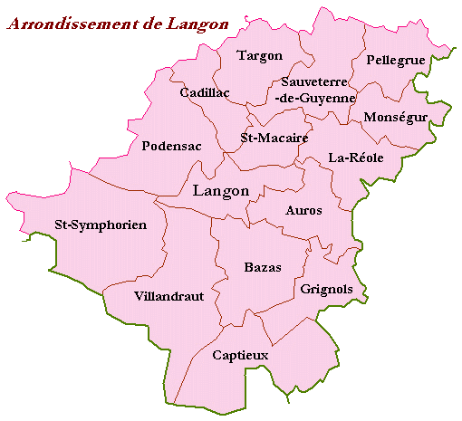
The district is subdivided into 15 cantons:
- Auros
- Bazas
- Cadillac
- Captieux
- Grignols
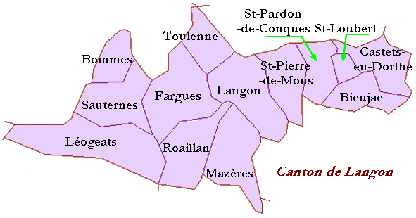
- Langon
- Monségur
- Pellegrue
- Podensac
- La Réole
- Saint- Macaire
- Saint- Symphorien
- Sauveterre -de- Guyenne
- Targon
- Villandraut
See also: List of cantons in the department of Gironde
Tourism
Castle Roquetaillade
Communities
The largest municipalities are the arrondissement ( > 5,000 inhabitants in 1999 ):
- Langon ( 6168 )
Agen | Arcachon | Bayonne | Bergerac | Blaye Bordeaux | Dax | Langon | Lesparre -Médoc | Libourne | Marmande | Mont -de- Marsan | Nerac | Nontron | Oloron -Sainte -Marie | Pau | Périgueux | Sarlat- la -Caneda | Villeneuve -sur -Lot
- Arrondissement in Aquitaine
- Gironde


