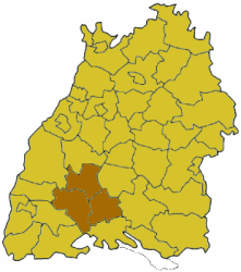
Baar (region)
With Baar Baar or high trough is today located in the core area at about 670-750 meters high plateau between the Black Forest and the Swabian Alb in southwestern Germany called. The name comes from the former country county Baar ( see also historical Baaren ), but had a slightly larger scale. The natural spatial Baar covers an area of 410 km ². The highest elevation is the Jura mountain - witnesses Lupfen with 977 meters; However, the predominant rock of the landscape is the shell, which is why the Baar is classified as part of the Gäue.
Nature regions
The Baar is a natural area of the Neckar and Tauber- Gäuplatten (main unit 12) in the South-West German cuesta. She leads the No. 121 in the systematics of the manual nature of the spatial structure of Germany and there divided into sub-units as follows (fractions ):
Limiting landscapes
The natural spatial main unit 121 is Baar, ordered clockwise, framed by the following main units:
- Upper Gäue (122 ) in the north
- Southwestern Albvorland (100 ) in the northeast
- Baaralb (92 ) in the east and southeast
- Alb- Wutach - field (120 ) in the southwest
- Southeastern Black Forest (154 ) in the west
- Central Black Forest (153 ) in the northwest
To Baaralb to the east and south of Baar is bounded by mountains with a relatively uniform height to 900 meters ( sheet pile, Furstenberg and others); to the southeast decreases the altitude for continuing the Gäue, but to Wutachschlucht draining Alb- Wutach area. From Hegau in the southeast it is separated by the ridge of the Baaralb and Hegaualb.
Landscape
On the Baar is the source of the Neckar ( Schwenningen moss ) and the so-called Source of the Danube in Donaueschingen Castle Park. The source rivers flowing there along the Danube - Brigach and Breg - spring but outside of the natural environment Baar near Furtwangen in the Black Forest and St. Georgen in the Black Forest. However, we find again on the Baar the sources of crows Bach and the Elta, the first tributaries of the Danube to the Donauversinkung at Möhringen, where the river seeps the majority of the year complete.
In Donaueschingen is a shallow cold air basin, which is one of the coldest spots in Germany. Here it is in the long-term average on 20 September for the first night frost - and even earlier than in the nearby Black Forest.
The northeast of Baar is a dissected by deep valleys landscape with witnesses Jura mountains such as the high carp and the Lupfen ( 976.6 m above sea level. NHN, King of Baar ) as highest point.
Cities and towns in Baar
The Baar as landscape forms the core area of the Schwarzwald- Baar- Heuberg region and includes the Schwarzwald- Baar district except the northwest territories, the western part of the district Tuttlingen and the southernmost part of the district of Rottweil and projects in the West to the district of Breisgau high black forest.
In the Baar are medium-sized cities and Donaueschingen Villingen -Schwenningen, with the western part of the district Villingen is already assigned to the Black Forest.
The small towns of Baar are (from north to south):
- Trossingen
- Bad Durrheim
- Braeunlingen
- Huefingen
Also Geisingen and Loeffingen and Blumberg are historically on the Baar, but are in the manual of the biogeographic division of Germany not the Baar assigned.
More independent communities are (from north to south):
- Dauchingen
- Hausen ob Verena
- Gunningen
- Durchhausen
- Tuningen
- Brigachtal
- Seitingen- Oberflacht
- Talheim
Also Mönchweiler and King in the Black Forest are sometimes associated with the Baar.
History
Originally there were three in the Carolingian Alamannia Baaren, the East, the West and the Albuinsbaar. It was this to be large administrative units, which consisted of several districts. The area of today Baar said the scenery was Adelhart Baar, a part of the West Baar. The area around Rottweil formed from the 8th to the 10th century the county Baar.
Later the Counts of Sulz were invested with the Baar, which appeared in the 11th century in this area. Count Hermann von Sulz left the county in 1282 Baar King Rudolf I, who gave it to Count Heinrich von Fürstenberg. His descendants it remained until the 19th century.


