Bechtsrieth
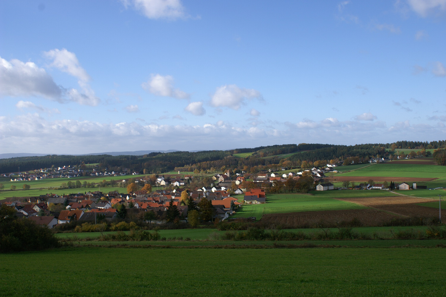
Bechtsrieth is a municipality in the Upper Palatinate district of Neustadt adWaldnaab and a member of the administrative community Schirmitz.
- 2.1 religions
- 2.2 Amalgamations
- 3.1 Coat of Arms
- 4.1 Structures
- 4.2 Natural Monuments
- 4.3 Sport
- 4.4 Regular events
- 5.1 traffic
- 5.2 Education
Geography
Geographical Location
Bechtsrieth is located in the Natural Park of Northern Upper Palatinate Forest ( Upper Palatinate Forest ), about four kilometers southeast of Weiden. The old town is crossed by Gleitsbach, a right tributary of the Luhe.
Community structure
The municipality has two Bechtsrieth officially named districts:
- Bechtsrieth
- Trebsau
Neighboring communities
- Irchenrieth
- Pirk
- Schirmitz
- Grazing
History
Bechtsrieth was mentioned in 1408 as Perchtersreuth, in 1436 as Perchtolzriet documented. The name suffix - reuth or - advised, which is related to the word clearing, suggests that Bechtsrieth was created as a clearing settlement in the framework of large land development from the 11th to the early 13th century on the upper reaches of the river Naab and their side runs. The most Gleitsbach, a tributary of the Luhe, location place was probably a clearing, which was headed by a Berthold. Such clearing manager usually led on behalf of the sovereign settlement willing farmers into previously unused areas. The country gentlemen were greatly interested in the development of their lands, as more agricultural land meant greater crop yields and thus higher tax revenues.
The northern Upper Palatinate was at least before the arrival of the first German settlers or Bavarian, but probably even during the first years and decades of clearing work, interspersed with widely dispersed Slavic settlement Islands. This is indicated, for example, the name of the Gleitsbaches and the neighboring village Trebsau that are Slavic after the Erlanger Professor Ernst Schwarz origin. Over centuries of coexistence, the Slavic population went up in the German population.
The Landgrave of Leuchtenberg had long term assets and rights in the place. Around the middle of the 16th century they owned in Bechtsrieth six yards and two fiefs. Around the middle of the 18th century consisted of 26 Bechtsrieth property and a shepherd's house. In addition to the farmers, there was a miller, a weaver, a tailor and a shepherd. In 1808, a tax district was formed from the village Bechtsrieth, the village Trebsau and the desert Trebsauermühle.
The community was a part Trebsau Landsassengut with the right to the lower courts. The noble seat was in the 18th to the mid 19th century in the possession of the family of price Ling. In whose coat of arms is the phoenix back in the front half of the shield of the coat of arms church today.
Founded in 1821, political communities Bechtsrieth ( with a then population of 30 families ) and Trebsau ( 23 families ) were merged in 1854 to the municipality Bechtsrieth.
After the end of World War II, the population Becht Rieths experienced a significant increase. First settled in the so-called old settlement of many displaced. Since the mid-1960s Bechtsrieth was as a residential area for commuters, mainly to pasture, very popular, which led to an expansion in particular the eastern residential areas. As before, there are several farms in the village.
Religions
Bechtsrieth and Trebsau together form a branch of the Catholic church parish Schirmitz whose filial church of St. Joseph is located in Bechtsrieth.
Incorporations
On 1 January 1978, the local government reform Bechtsrieth and Trebsau with Irchenrieth merged to form community Irchenrieth in the course. Since 1 January 1994 Bechtsrieth is following a popular again an independent municipality with the part locations Bechtsrieth and Trebsau.
Policy
Coat of arms
Blazon: Split of blue and silver, front a thriving rising from red flames silver phoenix, behind a blue bar.
The phoenix in the front half of the shield is taken from the coat of arms of the family of price Ling, who held Trebsau 1706-1848 the Landsassengut or patrimonial. Symbolically reminds the phoenix also to the rebirth of the community Bechtsrieth 1 January 1994, after the community had finally fought for years and with success against the 1978 carried out in the course of municipal reform merger with Irchenrieth. The back panel, in silver, a blue bar shows the coat of arms of the lamp Berger, had been part of their territory, the country county Leuchtenberg, the municipal area from the Middle Ages to the 17th century.
Culture and sights
Structures
Built in the 1930s, St. Joseph's Church is the branch church of the Catholic parish Schirmitz belonging filial community Bechtsrieth.
Natural Monuments
Situated east of Bechtsrieth to Weiden city area 631 m high Dreifaltigkeitsberg on which a homonymous chapel, provides a view over the municipality and the floodplain of the nearby Waldnaabtals. The ridge cross two long-distance trails, 176 km long and 660 km long Burgenweg Goldsteig.
Sports
- Gym and sports court
- Turnverein Bechtsrieth
Regular events
- Cross Country
Economy and infrastructure
Traffic
Bechtsrieth is located on the main road 22 (Würzburg -Bamberg - willow - Cham), which follow in this section of the old Bavarian Ostmark road and the tourist Glass Road. About the about seven kilometers away, Junction 25 ( willow -south) of the federal motorway 93 (Hof - Regensburg - willow Kiefersfelden ) Bechtsrieth is connected to the national road network. Bus number 11 of ÖPNVs that runs between pastures and Leuchtenberg / Oberviechtach, guaranteed by the Willows railway station to connect to the railway network, one running between pastures and Michldorf bike path also the connection to the remote network of cycle paths.
Education
In Bechtsrieth are guided in sponsorship of the Workers' Welfare kindergarten gang and a four-year primary school, which is attended by children from the neighboring village of Irchenrieth.


